Azcapotzalco (Mexico City)
Azcapotzalco is a historic borough (municipality) located in the northern part of Mexico City.
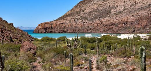
Azcapotzalco is situated in the Valley of Mexico, which is surrounded by mountains and volcanoes. The geography of the area is relatively flat and was once characterized by extensive lake systems, but many of them have been drained for urban development.
The environment in Azcapotzalco is urban and densely populated, with a mix of residential, commercial, and industrial areas.
Azcapotzalco is one of the 16 boroughs (municipalities) that make up Mexico City. It has its own local government and is responsible for providing various municipal services to its residents.
The town began in the pre-Hispanic era and was the seat of the Tepanec dominion until the Aztec Triple Alliance overthrew it. After that, it was a rural farming area becoming part of the Federal District of Mexico City in the mid-19th century.
In the 20th century, the area was engulfed by the urban sprawl of Mexico City.
Today it is 100% urbanized and is a center of industry.
Geography and Environment
The municipality of Azcapotzalco is in the Valley of Mexico with its eastern half on the lakebed of the former Lake Texcoco and the west on more solid ground. The historic center is on the former shoreline of this lake.
The average altitude is 2240 m above sea level.
It has a semi-moist temperate climate with an average temperature of 15 C.
As the municipality is 100% urbanized, there are no ecological reserves. There are 54 parks that have no wild vegetation but rather planted species such as willow, cedar, and pine trees.
These parks cover 100.51 hectares, which is 2.9% of the entire municipality. The most important of these are the Parque Tezozómoc and Alameda Norte, which together account for 52.4 hectares.
Parque Tezozomoc was inaugurated in 1982 and designed as a scaled replica of the Valley of Basin of Mexico in the pre-Hispanic era. The Alameda Norte park is next to the Ferrería station. It has a pond which was used as an ice rink and playing field but was rehabilitated in the 2000s.
Other important green areas include community squares such as Plaza Hidalgo, sports centers, college campuses, especially that of the Universidad Autónoma Metropolitana, community parks, and cemeteries.
Weather & Climate
Azcapotzalco, like the rest of Mexico City, experiences a highland climate due to its elevation. The climate is characterized by mild temperatures year-round, with cooler winters and warmer summers.
Average temperatures typically range from 12°C in the coldest months to 22°C in the warmest months. The rainy season usually occurs from June to October, with the rest of the year being relatively dry.
The best time to visit
The best time to visit Azcapotzalco and Mexico City in general is during the dry season, which is from November to May. This period offers pleasant weather with lower chances of rain, making it ideal for outdoor activities and sightseeing.
Communities
Originally the town of Azcapotzalco consisted of neighborhoods from the pre-Hispanic period. Many of these neighborhoods exist to this day, called colonias, barrios, or pueblos.
A number of them maintain individual cultural traits despite being fully engulfed by the urban sprawl of Mexico City. Today, the municipality has 61 colonias, 15 pueblos and 11 barrios. In 1986, INAH designated the center of Azcapotzalco as a historical monument.
In 2011, the historic center was designated as a “Barrio Mágico”.
The most important community remains the former town of Azcapotzalco, also called the historic center, marked by Plaza Hidalgo. This square consists of fenced stone paths surrounding gardens. Its two main focal points are a statue of Miguel Hidalgo y Costilla facing Avenida Azcapotzalco and a six-sided kiosk in the center.
On Saturdays, chess players convene to play during the afternoon. Café Alameda is on Plaza Hidalgo — a café and bar with a rock and roll theme. It has images of Jim Morrison, Freddie Mercury, Elvis Presley, and John Lennon lining its walls.
At night on weekends, it hosts live bands that attract youths from the area.
The Historic Archive of Azcapotzalco is on the south side of Plaza Hidalgo. It contains a mural painted by Antonio Padilla Pérez titled Origen y Trascendencia del Pueblo Tepaneca. The building contains archeological pieces.
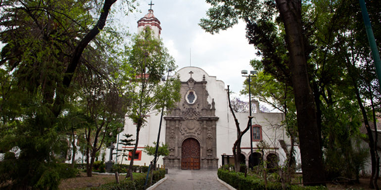
Across the street from the plaza are the parish church and the former municipal hall. The parish and former monastery of San Felipe and Santiago Apóstoles dates from 1565. It has the largest atrium in Mexico City, surrounded by a thick wall with inverted arches.
The main church has a large Baroque portal which contains the main door topped by a choir window. To the side, there is a slender bell tower with pilasters on its four sides. Under the tower, there is an image of a red ant.
A local legend says that when the ant climbs the bell tower, the world will end. To the right of the portal are three arches that front the former Dominican monastery. The interior of the church has a Baroque gilded altarpiece with Salomonic columns which contain images of the Virgin Mary. The main altar is Neoclassical.
To the side, there is a chapel called the Capilla del Rosario from 1720 with Baroque and Churrigueresque altars. The former cloisters have remains of their former mural work.
Next to the parish and taking over some of its former atrium space is the Casa de Cultura cultural center.
The building was constructed in 1891 originally as the municipal hall for Azcapotzalco. It has a sandstone portal with a balcony on the upper level featuring a double arch and an ironwork railing from 1894.
The building has three exhibition halls on the lower level.
The upper level is dedicated to the Sala Tezozomoc hall, larger than the lower halls combined. The garden areas have rose bushes and orange trees. These areas host art exhibits, workshops, classes, and other cultural events.
The center has a mural called La herencia tepaneca en ul umbral del tercer milenio by Arturo García Bustos, a student of Frida Kahlo and Diego Rivera. In 1986, the building was named a historic monument by INAH and converted into its current use in 1991 on its 100th anniversary.
The main street in the historic center is Avenida Azcapotzalco, which is home to long-established businesses. One of these is the Nevería y Cafetería El Nevado, which has a 1950s rock and roll atmosphere, uniformed waitresses, and mid-20th-century furnishings.
There are cantinas such as El Dux de Venicia (over 100 years old) with its original furniture and La Luna established in 1918 and noted for its “torta” sandwiches.
The Principe Tlaltecatzin Archeological Museum is a private institution founded by Octavio Romera that focuses on pre-Hispanic pieces related to the Azcapotzalco area. It is the result of a lifelong exploration and study of artifacts he found since he was a child. He educated himself and is considered an expert in the pre-Hispanic history and archeology of the area.
The oldest library of the municipality, Biblioteca Fray Bartolomé de las Casas, has murals by Juan O’Gorman.
In addition to the historic center, there are other important communities, many of which maintain old traditions. The Barrio de San Miguel Amantla is near the former 18 de Marzo refinery. It is one of the oldest in the municipality with one of the oldest churches.
In the Mesoamerican period, it was noted for its plumería, or the making of objects with feathers. The oldest standing church is in San Miguel Amantla which had fallen into ruins but was rebuilt using the original blocks.
Barrio de San Luis is one of over 20 which date from the Mesoamerican period. It is noted for its church and its barbacoa. The Barrio de Santa Apolonia Tezcolco was the site of the Tezozomoc’s treasury.
The Barrio de San Juan Tlilhuaca is the largest neighborhood in the municipality and contains the largest church. This church is famous for its passion play for Holy Week and is surrounded by old cypress trees said to have been planted as a tribute to Moctezuma.
During the late 19th and early 20th centuries, areas in the municipality became the site of country homes for the wealthy of Mexico City. Today a number of chalet and English-style homes with pitched roofs, towers, porches, and gardens can be seen especially in the Clavería neighborhood.
This neighborhood was as exclusive as Colonia Juárez and Colonia Condesa at that time. Of the housing developments construction in the latter 20th century, the most important is the Unidad Habitational El Rosario.
This apartment complex has 170 buildings, with 7,606 apartments housing over 50,500 residents. It is the largest of its kind in Latin America.
Origin of the name
Azcapotzalco (from āzcapōtzalli “anthill” + -co “place”; literally, “In the place of the anthills”) is one of the 16 municipalities (municipios) into which Mexico’s Mexico City is divided.
The name “Azcapotzalco” has its roots in the Nahuatl language, which was spoken by the indigenous people of the region before the Spanish colonization. It is believed to mean “anthill” or “place of the anthills.”
Azcapotzalco has a rich history that predates the arrival of the Spanish conquistadors. It was a prominent city-state in the pre-Columbian era and was known for its agricultural practices, particularly the cultivation of chinampas, which were artificial farming islands.
History
The name is derived from Nahuatl and means “ant hill” with the municipality Aztec glyph depicting a red ant surrounded by corn. It comes from a legend that says that after the creation of the Fifth Sun, the god Quetzalcoatl was tasked with recreating man.
To do this, he needed to enter the realm of the dead, Mictlan, to recover the bones of men from the Fourth Sun.
Ants helped Quetzalcoatl to find the realm of the dead and bring the bones up as well as grains of corn. Another version of the legend relates to the discovery of corn by observing that ants had put grains underground and corn plants grew there.
The very early history of the area follows that of the rest of the Valley of Mexico. About 7,000 years ago, hunter/gatherers arrived to the valley attracted by the vegetation and large game such as mammoths.
Fossilized mammoth, bison, and other bones were found when Line 6 of the Metro was constructed. When the large game died out, the inhabitants of the valley turned to agriculture, forming permanent villages sometime between 5000 and 2000 BCE.
Plants were domesticated — the most important of which were corn, squash, chili peppers, avocados, and beans.
Pottery and villages were founded all over the Valley of Mexico from 2200 BCE to 1200 BCE, supported by agriculture with some hunting and fishing. From 1200 to 700 BCE the most important villages were in the south of the valley.
Around 200 BCE, the Teotihuacan civilization arose and the Azcapotzalco area rose in importance as well, being in the empire’s political and cultural sphere. Villages that grew during this time included San Miguel Amantla, Santiago Ahuixotla, and Santa Lucia which are in the south of the modern municipality.
When Teotihuacan waned in 800 CE, the Azcapotzalco area remained important as a center of that culture, becoming an important ceremonial center. When Tula rose, Toltec influence then dominated Azcapotzalco and the rest of the Valley of Mexico.
Toltec influence is most evident in ceramic finds from Santiago Ahuizotla which was possibly a Toltec tribute city.
When Tula fell, there were new migrations into the Valley of Mexico including Otomis, Mazahuas, and Matlatzincas. One of these groups was led by a chieftain called Matlacoatl in the 12th century. Legend states that he established the village of Azcapotzaltongo, which is now Villa Nicolás Romero in 1152, but its development is best documented between 1200 and 1230. The village grew to become the Tepanec Empire in the 12th and 13th centuries with a ruling dynasty with the territory expanding over the Valley of Mexico. Acolhuatzin was the leader from 1283 to 1343. He married a daughter of Xolotl of Tenayuca and then moved the capital of the dominion to what is now the historic center of Azcapotzalco, on the edge of what was Lake Texcoco. He allowed the Mexica to settle on Tepaneca lands, founding Tenochtitlan, in exchange for tribute and military service. The last major ruler of Azcapotzalco was Tezozomoc who ruled from 1367 to 1427. Under him, the empire reached over most of the Valley of Mexico into Cuernavaca and north into Tenayuca and Atotonilco. This made Azcapotzalco the most important city in the Valley of Mexico and archeological work related to this dominion continues to this day.
In 2012, burials and remains of buildings were found in the San Simon Pochtlan neighborhood, believed to have belonged to Tepaneca traders between 1200 and 1300CE. Other settlements were found in the same area when Line 6 was constructed in 1980.
Under the Tepanecas, conquered areas were allowed to keep their own leadership as long as they paid tribute and performed military service. In 1427, these leaders included Nezahualcoyotl of Texcoco, Izcoatl of Tenochtitlan, and Totoquihuaztli of Tlacopan. When Tezozomoc died, there was a power struggle for the throne which allowed these tribute-paying entities a chance to rebel, forming the Triple Alliance and defeating Azcapotzalco in 1428. The former Tepanec lands were divided among the three leaders and the city of Azcapotzalco was destroyed and turned into a slave market.
With the end of the Tepanec Empire, political and economic power shifted to Texcoco, Tlatelolco, and Tenochtitlan.
The area remained ruled by the Aztec Empire until 1521 when the Aztecs fell to the Spanish when Azcapotzalco had a population of 17,000. From 1528 to 1529 the Dominicans were in charge of the evangelization of the area under Fray Lorenzo de la Asunción, who built churches of over the former Tepaneca ceremonial center dedicated to the Apostles Phillip and James. Despite accounts that Lorenzo de la Asuncion defended the indigenous against their Spanish overlords, during the 16th century, the indigenous population of the area fell from 17,000 to about 3,000 due to mistreatment and disease.
During the colonial period, the area not underwater was home to haciendas, resulting from the partition of lands among the conquistadors and their descendants. In 1709, Azcapotzalco was formed by 27 communities, divided into six haciendas and nine ranches. Azcapotzalco was the scene of one of the last battles of the Mexican War of Independence with the Army of the Three Guarantees under Anastasio Bustamante defeating royalist forces on August 19, 1821, shortly before Agustín de Iturbide entered Mexico City.
At the beginning of the 19th century, the area was rural, far outside Mexico City proper, part of the State of Mexico. It was organized as a municipality in 1824 with the town of Azcapotzalco serving as the seat of government for ranches and haciendas such as Ameleo, San Rafael, San Marcos, El Rosario, Pantaco, San Isidro, San Lucua, Acaletengo and Azpeitia along with communities such as Concepción, San Simón, San Martín, Santo Domingo, Los Reyes, Santa Catarina, Santa Bárbara, San Andrés, San Marcos, San Juan Mexicanos, San Juan Tlilhuaca, Xiocoyahualco, Santa Cruz del Monte, San Mateo, San Pedro, San Bartolome, San Francisco, Santa Apolonia, Santa Lucia, Santiago, San Miguel Ahuizutla, Santa Cruz Acayuca, Nextengo, San Lucas, San Bernabe, Santa Maria, San Sebastian and Santo Tomas. When it became part of the Federal District of Mexico City in 1854, Azcapotzalco was classified as a town as part of the Guadalupe municipality but in 1899 it became the head of its own municipality. The town of Azcapotzalco was still separate from Mexico City by about two leagues. In the 19th century, the community of San Juan Tlilhuaca was known for its warlocks. By the end of the 19th century, the municipality had a population of about 11,000 with 7,500 in the seat.
At that time, the area became popular with the wealthy who built country homes, especially along the Mexico-Tacuba road and near the town of Azcapotzalco. This construction was the forerunner of many of the municipality’s more modern neighborhoods. In the first decades of the 20th century, rail lines were constructed, including a trolley that connected the town of Azcapotzalco with Mexico City Center in 1913.
According to the 1900 census, the Federal District has an Azcapotzalco District which consisted of the municipalities of Azcapotzalco and Tacuba. These districts were eliminated in 1903, creating thirteen municipalities, of which Azcapotzalco was one. In 1928, the District was reorganized again into municipalities which the town of Azcapotzalco still heads.
From the end of the Mexican Revolution in 1920, the Mexico City area began a process of rapid growth, with the modernization of infrastructure and the establishment of industry in the area. The first factories in the municipality were established in Colonia Vallejo in 1929, which led to the industrialization of most of the area. The Refinería 18 de Marzo refinery was founded at the end of the 1930s and attracted even more industry. Today, it has been abandoned. In 1944, the federal government formally established the industrial zone of Colonia Vallejo. Around the same time, the government also established a major rail station for cargo at Pantaco.
The Industrialization created new residential neighborhoods, mostly for the working classes. Two exceptions were Colonia Clavería and Nueva Santa María which remained middle class in the mid-20th century, mostly descendants of those who had built country homes. In the latter 20th century, the rest of the vacant land in the municipality was built to make the territory 100% urbanized. The urbanized area in the municipality increased from 1.8% in 1940 to 95.2% at the beginning of the 1980s. Most of this last construction in the north and west was residential areas. In the 1970s, the Azcapotzalco campus of the Universidad Autónoma Metropolitana was established as a major educational center for Mexico City as well as the El Rosario apartment complex, the largest of its kind in Latin America.
Culture
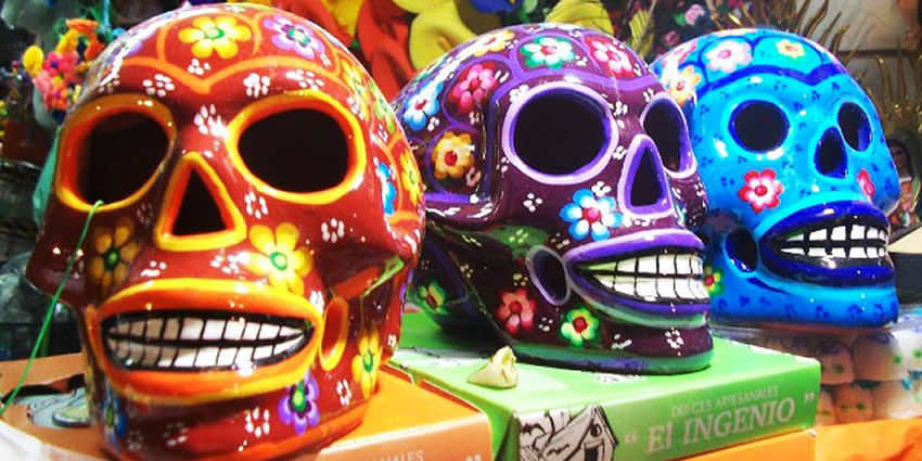
Residents of Azcapotzalco are referred to as Chintololos. There are several stories as to the origin of the term, but Azcapotzalco chronicler José Antonio Urdapilleta states that it came from a disrespectful Aztec term “tsintli- tololontic” which means excessively round buttock. Over time the pronunciation changed to the current and its disrespectful meaning disappeared.
Azcapotzalco holds one of the oldest continuous annual pilgrimages to the Basilica of Our Lady of Guadalupe, which has been done for over 475 years. It is considered to be the first one organized by the indigenous in Mexico with records indicating the first one done in 1532, only 11 months after the report of the appearance of the Virgin Mary to Juan Diego Cuauhtlatoatzin. The annual event is known as the Fiesta de los Naturales in which leaders from 28 communities collect money and more as an offering to Guadalupe. Before the procession sets off, there is a festival with fireworks and a mass to bless the pilgrims.
One legend of the area is about the “Enchanted Pool of Xancopina” a freshwater spring that existed during the pre-Hispanic era and where Moctezuma is said to have submerged much of his treasure after being defeated by the Spanish. It was where the Unidad Habitacional Cuitláhuac is now. The first El Bajio restaurant was founded in Azcapotzalco and is still in operation. The chain specializes in Mexican food from the center of the country.
Transportation
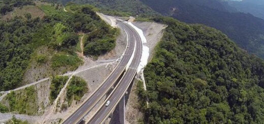
The municipality area has had a major road linking it to the historic center of Mexico City since the pre-Hispanic period, today called the Mexico-Tacuba road. It continues to be a major thoroughfare. The development of industry in the municipality, then extending north and west into the panhandle of neighboring Mexico State has prompted interconnected infrastructure, especially in transportation. Major thoroughfares of this type include Avenida Aquiles Serdán, Calzada Vallejo (Circuito Interior), Eje 3, Eje 4, and Eje 5 Norte, especially near the State of Mexico border. Because of its industry and links to other industrial areas in the State of Mexico, Azcapotzalco experiences very heavy traffic flow with an average of 800,000 vehicles transiting in or through it. Traffic jams are common, especially at rush hour and even at off-peak times due to faulty synchronization of traffic lights.
Mass transport options include the Mexico City Metro (with nine stations serving lines 6 and 7), the RTP bus system, the trolleybus system, and a number of privately owned buses and taxis. Together they transport an estimated 30,000 people per day. Much of this traffic is commuters coming into the municipality from the State of Mexico through the El Rosario metro station and bus terminal.
In the 19th century, a major rail station was constructed called the Pical-Pantaco terminal. It is used for shipping goods between Mexico City and the north of the country, and it has become an obstruction of traffic flow.
Let us know if this article was useful for you