Copper Canyon
Copper Canyon (“Barrancas del Cobre”) is a breathtaking natural wonder located in the northern part of Mexico. This vast and rugged canyon system is renowned for its stunning geography, unique environment, and diverse climate.
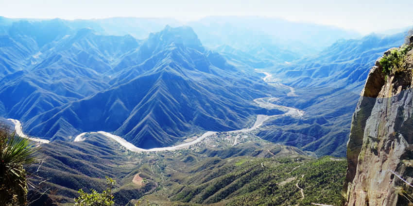
Copper Canyon is situated in the Mexican states of Chihuahua and Sinaloa. It is part of the Sierra Madre Occidental mountain range. It is actually a network of several canyons, each with its own distinct character.
The geography of Copper Canyon is nothing short of spectacular. It is a series of deep canyons, formed by six different rivers, including the Urique, Batopilas, and Copper rivers. The rugged terrain features steep cliffs, lush forests, and diverse flora and fauna.
All six rivers merge into the Rio Fuerte and empty into the Gulf of California.
The canyon system is home to various ecosystems, from pine forests in the higher elevations to subtropical vegetation in the lower regions. This diversity in landscapes and altitudes contributes to the unique environment of Copper Canyon.
The canyon’s name comes from the distinctive greenish-copper color of the canyon walls.
Copper Canyon is also known for its indigenous communities, such as the Tarahumara or Rarámuri people, who have inhabited the region for centuries and are known for their long-distance running abilities.
Climate & Weather
Copper Canyon’s climate varies significantly depending on the elevation. In the higher altitudes, temperatures can be quite cold, especially during the winter months. Snowfall is not uncommon in these areas.
The alpine climate of the mountainous regions of Copper Canyon has moderate temperatures from October to November and March to April. The bottom of the canyons are humid and warm and remain that way throughout the year.
As you descend into the lower parts of the canyon, the climate becomes more temperate and even subtropical in some areas. Summers tend to be warmer, with temperatures in the lower canyons often reaching hot levels.
During the warmest months, April through June, drought is a problem with little rainfall until July when the rainy season begins.
The best time to visit Copper Canyon
The best time to visit Copper Canyon depends on your preferences and the type of activities you plan to engage in.
For those who want to explore the Copper Canyon’s beauty without extreme temperatures, the ideal time is during the spring and fall (March to May and September to November).
The weather is mild, and the landscape is lush and vibrant during these months.
If you’re interested in witnessing the unique culture of the Tarahumara, consider visiting during their major cultural events and festivals, such as Semana Santa or the Ultramarathon races, which are held in late February or early March.
History
The New Spanish arrived in the Copper Canyon area in the 17th century and encountered the indigenous locals throughout Chihuahua. For the New Spanish, America was a new land to explore for gold and silver and also to spread Christianity.
The New Spanish named the people they encountered “Tarahumara”, derived from the word Rarámuri, which is what the indigenous people call their men. Some scholars theorize that this word may mean ‘The running people’.
During the 17th century, silver was discovered by the Hispanics in the land of the Tarahumara tribe.
Some were enslaved for mining efforts. There were small uprisings by the Tarahumara but to little avail. They eventually were forced off the more desirable lands and up into the canyon cliffs.
Flora and fauna
The Sierra Tarahumara Occidental region contains numerous species of pine and oak trees. Mexican Douglas-fir trees cover the high plateaus in altitudes over 2,400 m, but due to deforestation in the area, many species of wildlife are endangered.
Cougars live in the remotest of regions and are rarely seen.
After the summer rainy season, these upper regions blossom with wildflowers until October.
From 1,200–to 2,400 m, oak trees grow in huge forests as well as the more shade-tolerant types of trees. In the fall the forests become brilliant with color from Andean alder and poplar trees.
Brushwood and scrubby trees grow on the canyon slopes, which can accommodate the dry season. Huge fig and palm trees thrive at the bottom where water is plentiful and the climate is tropical.
Threats to the ecosystem
Due to increases in human population, there are many threats to the ecosystems of the Sierra Tarahumara Occidental region.
The government funding to build a “tourist-friendly” atmosphere poses threats to the environment and indigenous cultures. Roads have been built in the former isolated mountainous zones.
Agriculture and grazing as well as the cutting of hardwoods and other trees for firewood has accelerated a soil erosion problem.
Mesquite (Prosopis spp.) and desert ironwood trees are cut and exported primarily to the U.S. for charcoal. Amapa trees yield highly prized lumber for building and furniture making. Other trees are also cut and sold for their high-priced lumber.
Over-harvesting of the forests in the area has caused the extinction of the imperial woodpecker and Mexican wolf.
Approximately, two percent of the original old-growth forest remains.
However, a massive forest-harvesting project in the region has been abandoned, for now, by the World Bank. The Mexican forestry department deemed these species of trees “legally protected,” but enforcement is difficult.
The government has taken measures to halt or slow down the cultivation of opium poppies and cannabis by spraying crops with herbicides, which threaten the populations of many different species.
A large saturnid moth (Rothschildia Cincta) is one of the species that are threatened by the spraying. Their cocoons are used by the native population for ceremonial purposes.
Open-pit mining for copper, gold, and other metals not only produces air pollution from smelters but has been linked to the serious decline of the Tarahumara frog (Rana tarahumarae).
Every river system has been dammed causing fresh water shortages in nearby desert communities.
An enormous dam is being constructed on the Rio Fuerte, which poses major environmental problems and may lead to massive losses of tropical forests and habitats.
Conservation is underway but remains informal and slow. Mexico has environmental laws but suffers from a lack of financial resources. Enforcement has been lax or non-existent.
Agencies are actively trying to increase the protection of natural preserves.
Indigenous communities
Copper Canyon’s traditional inhabitants are the Tarahumara or Rarámuri.
With no official census, the population of the Rarámuri people probably ranges between 35,000 and 70,000.
Many Rarámuri reside in the cooler, mountainous regions during the hot summer months and migrate deeper into the canyons in the cooler winter months, where the climate is more temperate.
Their survival strategies have been to occupy areas that are too remote for city people, way off the beaten path, to remain isolated and independent, so as to avoid losing their culture.
Their diet is largely domestic agrarian but does consist of meat from domesticated cows, chickens and goats, wild game, and freshwater fish. Corn (maize) is the most important staple of the Rarámuri’s diet.
The Rarámuri people are known for their endurance running. Living in the canyons, they travel great vertical distances, which they often do by running nonstop for hours.
A popular Rarámuri community race called Rarajipari is played by kicking a wooden ball along the paths of the steep canyons.
Tourism is a growing industry for Copper Canyon, but the acceptance of it is debated in the local communities.
Some communities accept government funding for building roads, restaurants, and lodging to make the area attractive for tourists.
Many other groups of Rarámuri maintain their independence by living in areas that are as far away from city life as possible. Their way of life is protected by the mountainous landscape.
Tourism
There are many other ways to explore Copper Canyon such as hiking, biking, driving, or horseback riding.
The most popular way is by train, as the Ferrocarril Chihuahua al Pacífico or ChePe, runs along the main canyon called Canyon Urique, between Chihuahua and Los Mochis, on the Gulf of California.
The Chihuahua al Pacifico began in the late 19th century.
The revolution, lack of funding, and the overall difficulty of building a railroad over such terrain hindered its completion until 1961.
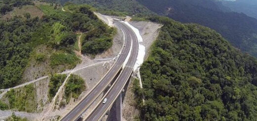
The railroad comprises 405 miles of rails with 39 bridges and 86 tunnels. The total trip takes approximately 15 hours and passes through towns, as well as the towering cliffs of the canyons.
Along the railway, many Tarahumarans lay out their food, crafts, and other wares for sale.
Mexico established the Parque Nacional Barranca del Cobre (Copper Canyon National Park) to showcase this remote area. The park is located in the municipalities of Batopilas, Bocoyna, Guachochi, and Urique.
The Basaseachic Falls National Park around the Basaseachic Falls is located within the canyon area.
Cities and towns
Among the villages located in or on the Copper Canyon are:
Bahuichivo, ChePe train stop for Cerocahui, Urique, Piedras Verdes, Tubares.
Basaseachi, located near the pour off of 246 m Cascada Basaseachi in the Barranca Candameña. The towns and ranchos of San Lorenzo, Cahuisori, and Huahumar encircle the rim of the canyon, also home to Mexico’s highest waterfall Piedra Volada.
It is on the main Federal Highway 16 between Chihuahua, Chihuahua, and Hermosillo, Sonora. The Rio Candameña is a tributary of the Rio Mayo which flows into the Gulf of California.
Batopilas, elevation 600 m, is a town on the Batopilas River at the bottom of a canyon; first established by the Spanish around 1632 to mine silver. It is located 30 km southeast of Urique.
Bocoyna, 30 km east of Creel, and on the eastern escarpment of the continental divide.
The nearby Rio Conchos flows into the Rio Bravo (Rio Grande) on the Mexico-Texas border. Carichí, Sisoguichi, and Panalachi are important Tarahumara settlements on the Rio Conchos drainage system.
Cerocahui, 14 km S. of the train stop at Bahuichivo.
Creel, atop the canyon and, at 2,340 meters altitude, marking one of the highest points on the ChePe railroad route (San Juanito is higher at 2,400 meters; a central point for commerce and tourism.
Divisadero is a key train stop and vista point with amazing views down into the Urique Canyon of the Barranca del Cobre. The ChePe train allows a 15-20 minute stop for visitors to enjoy the view.
Divisadero and nearby Areponapuchi (located 4 km south) are major canyon-rim trailheads for hiking into the Rio Urique canyon.
This high mesa is home to three tourist-class hotels strategically located on the canyon rim, and several low-budget guesthouses offering basic accommodations with meals included.
Témoris is a dual town located 400 m apart in elevation. The ChePe train traverses the valley 3 times including a mile-long tunnel to gain elevation. Located on the Rio Septentrion, lower Temoris is at 1000 m.
Urique, 560 m. Located at the bottom of the canyon rim below Bahuichivo, on the Urique River. It is 30 km NW of Batopilas, now connected by a rough road.
Let us know if this article was useful for you