Culiacan
Culiacán is the largest city and the capital of the state of Sinaloa, in northwestern Mexico.
Culiacán is also the seat of Culiacán Municipality. There are 675,773 inhabitants in the city (census of 2010) and 858,638 in the municipality. While the municipality has a total area of 4,758 sq km, the city itself is dense, at only 65 sq km.
Culiacán is situated in a valley surrounded by the Sierra Madre Occidental mountain range. It is positioned inland from the Gulf of California (Sea of Cortez) and is relatively close to the Pacific Ocean.
The city is located in a valley at the confluence of the Tamazula and Humaya Rivers, where the two meet to form the Culiacán River, 55 m above sea level. Culiacán is about the same distance from Los Mochis, Mazatlán, and Altata.
The city is known for its agricultural productivity, as the surrounding region benefits from fertile soil and a relatively mild climate. Culiacán’s economy is heavily tied to agriculture, with crops like tomatoes, chili peppers, and beans being significant contributors.
Weather & Climate
Culiacán experiences a tropical savanna climate with distinct wet and dry seasons.
Summers are very hot and humid, shade temperatures can reach 45 °C, and high humidity can produce heat indices of 50 to 55 °C, with the risk of heavy rainfall from decaying tropical cyclones also present.
The rainy season typically falls between June and September, with the heaviest rainfall occurring in August.
Winters are milder, with average temperatures ranging from 20°C to 25°C.
The best time to visit Culiacán
The best time to visit Culiacán is during the dry season, which spans from October to May.
During this period, the weather is more comfortable for outdoor activities and exploration. The spring months, particularly March and April, offer pleasant temperatures and blooming vegetation.
Origin of the name
The name “Culiacán” is believed to have indigenous origins.
The most accepted translation would be Colhuacan “place of those who adore the crooked god Coltzin”. This name likely refers to the native inhabitants and their religious practices.
Another translation may be from the word “coahuacan”, which can mean “palace of snakes”.
History
Precolonial period
Before the Spaniards arrived, this site had been a small Indian settlement since 628 when Amerindians had first founded it.
Foundation
The city existing today was founded in 1531 by the Spanish captain Nuño Beltrán de Guzmán and named San Miguel de Culiacán. In the same decade, it was the terminus of the long journey of Alvar Núñez Cabeza de Vaca and company among natives.
Explorer Francisco Vásquez de Coronado set out from Culiacán to explore what is now the southwestern United States. Settlers from Europe came to Culiacán, and in the following centuries, Culiacán continued to be a quiet town.
- 1824: Culiacán became the capital of Sinaloa.
- Late 19th Century: The city experienced growth due to mining and agriculture.
- 1915: Culiacán was captured during the Mexican Revolution by the forces of Pancho Villa.
Tourist Attractions & Sightseeing
FORUM Culiacán Mall is the largest mall in Culiacán.
It offers Liverpool, Sears, Steve Madden, Pull and Bear, Zara, C&A, Lacoste, Nine West, Victoria’s Secret, MacStore, Starbucks, Sanborn, and Tous stores, a Cinemex movie theater, MixUp, boutiques, kiosks, a food area, and an HSBC.
Plaza Galerias San Miguel is the second-largest mall. It offers Sears, Citi Cinemas movie theater, and mainly shoe stores.
Plaza Cinépolis is a modern plaza/little mall in the western part of the city, and it is the only place in Culiacán where one can find the Cinépolis movie theater. It offers many boutiques and some famous restaurants in the city.
Plaza Fiesta is a plaza located in the city center. It offers Coppel, a Ley Plaza (supermarket), restaurants, little boutiques, and shoe stores.
Plaza La Campiña is a plaza mall in the eastern section of the city, near the Culiacán River. It offers Pavi, Coppel, a Mega Plaza/Comercial Mexicana (Super Market), many boutiques, jewelers, and seasonally a go-kart track.
Ernesto Millán Escalante Park (previously known as Culiacán ’87) has many pools, attractions, an artificial lake, gardens, sports courts, the longest water slide in northern Mexico, and an open-air Hellenic theatre.
Revolución Park
Culiacán’s civic center is located in the eastern city at the Malecón Viejo, facing the Tamazula River. It has the Culiacán Library, the Culiacán Zoo, the second Dancing Fountains in the city where people go when it is hot, sports courts, a big run track, and a Hellenic theater.
Las Riveras Park is located around the Tamazula River, between Forum Culiacán Complex, the Isla de Orabá Park, the Malecón Viejo, and the Malecón Nuevo. It has only pedal boats and a tyrolean across the river, a bike path, and recreational games.
Splash Club! is one of the largest water parks in the state of Sinaloa.
Nearby towns and villages:
La Primavera is a small and private urbanized zone in the south of the city.
La Primavera contains many houses, two schools, a little mall next to the channel, a sports club, and a group of channels connected to the biggest lake in Culiacán, where anyone can fish and go camping.
El Conchal and other small villages with a population of 500 or less where people live on fishing and tourism.
Nearby tourist Attractions
Imala’s hot springs are about a 30-minute ride from the city and close to several dams and reservoirs, where one can fish largemouth bass all year round.
Altata Beach, located 30 minutes from Culiacán, has had extensive development over the last few years. It has a “sister” beach called Isla Cortés or Nuevo Altata, where this project of travel destination, has begun with some restaurants and private areas.
It is famous for its blue sea, white sand, modern restaurants and bars, nightclubs, and high sea waves.
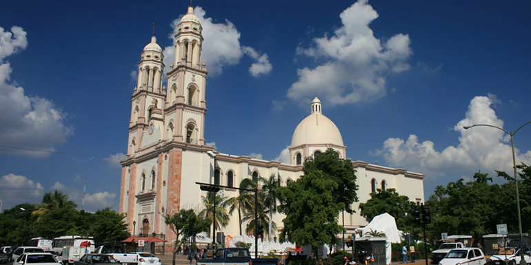
The Cathedral, a 19th-century church, began construction in the 1830s.
Plazuela Alvaro Obregón was the place for social gatherings in the 1800s.
La Lomita or Templo de Nuestra Señora de Guadalupe is the tallest church in Culiacán, situated on a hill with a view of the entire city.
The Centro Cultural Genaro Estrada, known by the locals as “Difocur”, encompasses a theater, movie theater, a café, and a group of museums specialized in local culture. DIFOCUR is also the home of the Orquesta Sinfonica Sinaloa de las Artes.
The OSSLA performs a 42-week season (September to June) of symphony, pops, opera, ballet, and chamber music, and features musicians from more than 15 different countries, including Mexico, the United States, England, Scotland, Canada, Romania, Argentina, and others. Working under the auspices of the government of Sinaloa, the OSSLA also performs many outreach and educational programs around the state of Sinaloa, as well as throughout Mexico.
The Regional History Museum in the “Parque Constitución”, a large art museum downtown and a number of small art galleries, is owned by several of the local universities.
The Botanical Garden and Centro de Ciencias de Sinaloa, a science museum, holds the fifth-largest meteorite on earth.
A baseball stadium, the Estadio Angel Flores, is the home of Los Tomateros de Culiacan; a bigger football arena, called Estadio Banorte (formerly Estadio Carlos González), is the home of Los Dorados de Sinaloa, a Mexican football team. Several university stadiums are also available.
In Downtown, the best preserved old street is the Calle Rosales, between Rosales Square and the Cathedral.
Transportation
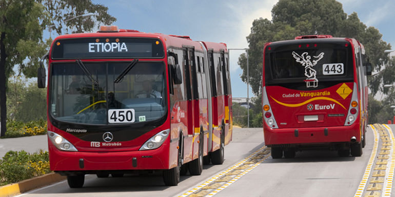
Urban transport: At present, Culiacán has just over 68 urban transport routes, which serve about 1 million users. The Culiacán urban transport is operated by RedPlus.
Rail: The city has a train station, operated by Ferromex, and it is used only to transport freight. It is connected to the south with Mazatlán and north with Guaymas.
Bus station: Culiacán uses the Central Internacional de Autobuses “Millennium” (“Millennium” International Buses Station) to travel across all of Mexico (north, central, and south) and to the United States (Arizona and California).
This replaced the old bus terminal in the southern city.
Roads and expressways: Though several high-speed roads have been built, most of the city’s streets are rather narrow and traffic jams are common at rush hours. Now, 300,000 cars are in Culiacan, making the per capita number of cars one of the highest in the country considering the 745,000 inhabitants.
Bridges and tunnels
The city has a total of 13 bridges: six across the Tamazula River, two spanning the Humaya River, and the longest one with four crossing the Culiacán River. Efforts to solve traffic problems have been made, but most of the city streets and bridges are now crowded and insufficient to handle regular and rush-hour traffic; a 40-km/h speed limit in most parts of the city worsens the situation.
- Musalá Bridge (Tamazula River)
- Musalá-Universitaria Bridge (Tamazula River)
- Benito Juárez Bridge (Tamazula River)
- Morelos Bridge (Tamazula River)
- Miguel Hidalgo Bridge (Tamazula River)
- Juan de Dios Bátiz-Tres Ríos Brige (Tamazula River)
- Josefa Ortíz de Domínguez Bridge (Humaya River)
- Rafael Buelna Bridge (Humaya River)
- Jorge Almada Bridge (Culiacán River)
- Black Rail Brige (Culiacán River)
- Rolando Arjona Amabilis-UDO (Culiacán River)
- USE-Valle Alto (Culiacán River)
- Libramiento Recursos (Rosales Channel)
- Eje Federalismo Bridges (Rosales Channel)
- Chavez Castro Bridge (Rosales Channel)
- Emiliano Zapata Pass Bridge (Rosales Channel)
On Feb. 17, 2014, investigators from Mexico and the United States learned Joaquín Guzmán Loera, or El Chapo, was using underground sewage tunnels in Culiacán by constructing hatches connecting to the drainage network in the bathtubs of his city “stash houses”.
On at least one occasion, authorities chased Guzman into the tunnels but lost him. An AP reporter said some of the tunnels were well-lit, had wood paneling, and were air-conditioned.
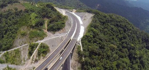
Highways and freeways
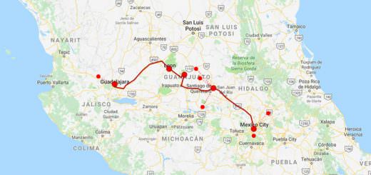
Culiacán is a rail junction and is located on the Panamerican Highway that runs north to the United States and south to Guadalajara and Mexico City, and the Benito Juárez Highway or Maxipista, which is a toll road that runs parallel to the toll-free federal highway. It is connected to the north with Los Mochis and to the south with Mazatlán, Tepic, and Guadalajara with the Federal Highway 15.
- Mexican Federal Highway 15 (north: Los Mochis, south: Mazatlán)
- Sanalona Free Highway (southeast: Sanalona (exit)/Cosalá)
Culiacán is linked to the satellite city of Navolato by an excellent freeway that now reaches Altata, in the Pacific Ocean coast. Culiacán is also linked to Tamazula de Victoria in Durango state.
- Freeway 280-30 (west: Navolato-Altata)
- Freeway 3-225 (north: Melchor Ocampo-Guamuchil)
- Freeway 5-325 (south: Costa Rica-El Dorado)
- Tamazula Interstate Freeway (northeast: Sanalona-Tamazula de Victoria)
Airport
Culiacán is served by Federal de Bachigualato International Airport (IATA: CUL, ICAO: MMCL), the most important domestic gateway in the state of Sinaloa, and the second in international operations after Mazatlán International Airport.
It is located south of downtown; it is also the 10th Mexican Air Force base.
Tourist Assistance + Emergency Numbers
You can dial 078 from any phone, where you can find free information about tourist attractions, airports, travel agencies, car rental companies, embassies and consulates, fairs and exhibitions, hotels, hospitals, financial services, migratory and other issues.
Or dial the toll-free (in Mexico) number 01-800-006-8839.
You can also request information to the email correspondencia@sectur.gob.mx
MORE EMERGENCY NUMBERS:
General Information: 040 (not free)
National Emergency Service: 911
Radio Patrols: 066
Police (Emergency): 060
Civil Protection: +52(55)5683-2222
Anonymous Complaint: 089
Setravi (Transport Mobility): +52(55)5209-9913
Road Emergency: 074
Cruz Roja: 065 o +52(55)5557-5757
Firefighters: 068 o +52(55)5768-3700
Let us know if this article was useful for you