Puerto Vallarta
Puerto Vallarta is a Mexican beach resort city situated on the Pacific Ocean’s Bahía de Banderas. The 2010 census reported Puerto Vallarta’s population as 255,725 making it the fifth largest city in the state of Jalisco, and the second largest urban agglomeration in the state after the Guadalajara Metropolitan Area. The City of Puerto Vallarta is the government seat of the Municipality of Puerto Vallarta which comprises the city as well as population centers outside of the city extending from Boca de Tomatlán to the Nayarit border (the Ameca River).
The municipality has an area of 1,300.7 square kilometres (502.19 sq mi). To the north it borders the southwest part of the state of Nayarit. To the east it borders the municipality of Mascota and San Sebastián del Oeste, and to the south it borders the municipalities of Talpa de Allende and Cabo Corriente.
Puerto Vallarta was once named as La ciudad más amigable del mundo (The Friendliest City in the World), as the sign reads when entering from Nayarit. Today, the presence of numerous sidewalk touts selling time-shares and tequila render the city’s atmosphere more akin to tourist-heavy resorts like Cancun and Acapulco, but overall the city’s reputation remains relatively undiminished.
Geo & Climate
Geographical characteristics
Puerto Vallarta lies on a narrow coastal plain at the foot of the Sierras Cuale and San Sebastián, parts of the Sierra Madre Occidental. The plain widens to the north, reaching its widest point along the Ameca river. Three rivers flow from the Sierra through the area. From south to north they are the Cuale, the Pitillal, and the Ameca. A number of arroyos also run from the Sierra to the coastal plain. Many of the valleys of these rivers and arroyos are inhabited. Also development has to some extent spread up the hillsides from the coastal plain.
The city proper comprises four main areas: the hotel zone along the shore to the north, Olas Altas – Col Zapata to the south of the Cuale river (recently named Zona Romantica in some tourist brochures), the Centro along the shore between these two areas, and a number of residential areas to the east of the hotel zone. The oldest section of the town is the area of Col. Centro near the church of Our Lady of Guadalupe, especially Hidalgo street.
Seismic history
Puerto Vallarta, like much of the west coast of North America, is prone to earthquakes, though Puerto Vallarta tends to experience only peripheral effects of earthquakes centered further south. In 1995, an earthquake located off the Colima coast shook the crown from the top of the Roman Catholic Church.
Climate
Puerto Vallarta’s climate is typical Tropical wet and dry. The average daily high temperature is 86 °F (30 °C); average daily low temperature is 70 °F (21 °C); average daily humidity is 75%. The rainy season extends from mid June through mid October, with most of the rain between July and September. August is the city’s wettest month, with an average of 14 days with significant precipitation. Even during the rainy season precipitation tends to be concentrated in large rainstorms. Occasional tropical storms will bring thunderstorms to the city in November, though the month is typically dry. There is a marked dry season in the winter. February, March and April are the months with the least cloud cover.
Prevailing winds are from the southwest, and most weather systems approaching Puerto Vallarta are consequently weakened as they pass over Cabo Corriente. Thus even during the rainy season Puerto Vallarta’s weather tends to be mild compared to other areas along the Mexican Pacific coast.
Hurricanes seldom strike Puerto Vallarta. In 2002, Hurricane Kenna, a category 5 hurricane, made landfall about 160 km (100 mi) northwest of Puerto Vallarta, and the city suffered some damage from the resulting storm surge. In 1971, Hurricane Lily, a category 1 hurricane, caused serious flooding on the Isla Cuale, prompting the city to relocate all of its residents to the new Colonia Palo Seco.
Hurricane Patricia
Hurricane Patricia, a Category 5 storm, became the most powerful cyclone ever measured in the Western Hemisphere with sustained wind speeds up to 200 mph (320 kph). Hurricane Patricia was forecast to make landfall at Puerto Vallarta on the evening of October 23, 2015, with catastrophic damage predicted for the town and surrounding areas and the potential for mud slides. The storm changed from a Category 1 to a Category 5 in just 24 hours, thus catching some vacationers off guard and leaving many trapped in the town. The Jalisco state government put together 30 buses to evacuate tourists from the coast to Guadalajara, a 5-hour ride inland. Manzanillo, Colima was also near the forecast catastrophic damage zone. Ultimately, Patricia made landfall south of Puerto Vallarta sparing the city from any significant damage.
Origin of the Name & Heraldry
Puerto Vallarta is named after Ignacio Vallarta, a former governor of Jalisco. In Spanish, Puerto Vallarta is frequently shortened to “Vallarta”, while English speakers call the city P.V. for short.
In internet shorthand the city is often referred to as PVR, after the International Air Transport Association airport code for its Gustavo Diaz Ordaz International Airport.
History & Timeline
Puerto Vallarta’s proximity to the Bay of Banderas, the agricultural valley of the Ameca River, and the important mining centers in the Sierra have given the town a more interesting past than most Mexican tourist destinations. Puerto Vallarta was a thriving Mexican village long before it became an international tourist destination. Tourism was a major economic activity because of the climate, scenery, tropical beaches, and rich cultural history.
Pre-Hispanic times to the 19th century
Few details are known about the history of the area prior to the 19th century. There is archaeological evidence to suggest continuous human habitation from 580 BC, and similar evidence (from sites near Ixtapa and in Col. Lázaro Cardenas) that the area belonged to the Aztatlán culture which dominated Jalisco, Nayarit and Michoacán from c. 900–1200. The limited evidence in occidental Mexican archeology have limited the current knowledge about pre-historic life in the area.
Spanish missionary and conquistador documents chronicle skirmishes between the Spanish colonizers and the local peoples. In 1524, for example, a large battle between Hernán Cortés and an army of 10,000 to 20,000 Indians resulted in Cortés taking control of much of the Ameca valley. The valley was then named Banderas (flags) after the colorful standards carried by the natives.
Also the area appears on maps and in sailing logs as a bay of refuge for the Manila Galleon trade as well as for other coastal seafarers. As such it figures in some accounts of pirate operations and smuggling and pirate contravention efforts by the viceregal government. During the 17th and 18th centuries the Banderas Valley and its beaches along the Bay of Banderas served as supply points for ships seeking refuge in the bay. The area also served as a point where smuggled goods could be sent on to the Sierra towns near Mascota, evading the customs operations at San Blas, Nayarit.
El Carrizal and Las Peñas – 19th century
During the 19th century the history of Puerto Vallarta, then called El Carrizal or Las Peñas, was linked to the history of the Sierra towns of San Sebastian del Oeste, Talpa de Allende and Mascota. While today these towns are considered quaint tourist destinations, during much of the 18th century, Mascota was Jalisco’s second largest town, after Guadalajara. Mascota and its neighboring towns located in the high plateaus of the Sierra, developed as agricultural towns to support the growing mining operations in the Sierra.
During the 18th century, as Mascota grew, Puerto Vallarta grew with it, transforming itself from a small fishing and pearl-diving village into a small beach-landing port serving the Sierra towns. At the time the main port serving Jalisco was located at San Blas, but the inconvenient overland route from San Blas to the Sierra towns made Puerto Vallarta a more convenient alternative for smaller shipments, not to mention smuggling operations which evaded the tax collectors at San Blas. Puerto Vallarta also became a vacation destination for residents of the Sierra Towns, and by the mid 19th century, the town already had its regularly returning population of vacationers. Most of the early settlers in Puerto Vallarta were families who had left the Sierra towns for one reason or another.
1859 saw an important turning point for the small village, then known as Las Peñas. That year the Union en Cuale mining company took possession of land extending from Los Arcos to the Pitillal river and extending back up into the Sierra for kilometres. The Union en Cuale company was owned in part by the Camarena brothers of Guadalajara who had developed a small trade in oil palm in Las Peñas. The purpose of the government’s sale of the land to the company was to provide for shipping, fishing and agricultural support for the mining operations which were growing quite quickly in the Sierra.
The official founding story of Las Peñas and thus of Puerto Vallarta is that it was founded by Guadalupe Sánchez Torres, on December 12, 1851, as Las Peñas de Santa María de Guadalupe. Unfortunately the record of Sr. Sanchez’s purchase of property in Las Peñas dates the sale to 1859. Also even as early as 1850 the area was already peopled by fishermen, pearl divers, smugglers and foragers, all of whom had something of a permanent existence in the area. Given the existing historical documents it is simply impossible to date the first permanent settlement in the area,
There is however no doubt the development of Las Peñas into a self-sustaining village of any significant size happened in the 1860s as the mouth of the Cuale area was exploited to support the operations of the newly enfranchised Union en Cuale company. As such 1859 marks the beginning of Puerto Vallarta as a village. Twenty years later, by 1885, the village comprised about 250 homes and about 800 residents.
The early municipality – early 20th century
In 1918, the village was elevated to municipality status and renamed after former state governor Ignacio Vallarta. During the early years of the 20th century, most of Puerto Vallarta was owned by the Union en Cuale company controlled by the American Alfred Geist. Geist sold land only in large plots at prices that were quite high for the time and otherwise leased the land on short term leases. To remedy this situation and to enable the new municipality to develop, the citizens petitioned the government for a land grant based on the new constitution’s provisions.
In 1921, the Local Agrarian Commission approved a grant of some 9,400 hectares (23,000 acres; 36 square miles), with the land to be expropriated from the Union en Cuale company. The grant was established as an ejido holding (a farming cooperative administered by the government). Legal squabbling over the size of the land grant, and the ejido status of the properties involved would stymie growth in Puerto Vallarta into the 1960s, as developers were reluctant to build anything too substantial on land for which one could not obtain clear title. (Ejido land is controlled by individuals who are given licenses to use it, but it could not be sold, subdivided or leased.)
During the Cristero War, the municipality was twice taken over by Cristero forces (April 1927 and January 1928). After it was recaptured for a second time, the national government stationed a small garrison there under Major Ángel Ocampo. The garrison was stationed near the mouth of the Cuale River and is responsible for planting many of the palms that now line the beaches near the mouth of the Cuale River to help limit beach erosion during heavy rains in October 1928. One casualty of the skirmishes was local pastor Padre Ayala who was exiled to Guadalajara for his role in fomenting the local revolt. He died there in 1943, though his remains were returned 10 years later and interred in the main parish church of Our Lady of Guadalupe.
As mining activities in the Sierra waned in the early years of the 20th century, Puerto Vallarta and the agricultural valley to the north of the city became important destinations for those leaving the Sierra towns and looking for a place to settle. Many of those who arrived had family members already living in Puerto Vallarta, and the pattern of migration that ensued turned the town into a collection of more or less extended families, giving it the cohesion of a typical sierra town.
From 1925 until 1935, the Montgomery Fruit Company operated in the area around Ixtapa. Friction with the state government over labor issues eventually led to the venture being abandoned, but for ten years it provided an important source of employment in the area.
The first airplane service arrived in 1932, with electrical service on a small scale arriving about the same time. The first suspension bridge over the Cuale went up in 1933. The city’s first plumbing system was started in 1939. In 1942, Puerto Vallarta was finally connected by road to Compostela, Nay. Until then the only access to Puerto Vallarta was by sea, air, or by mule trails to the sierra towns. Also in 1942, in the New York-based magazine Modern Mexico the first advertisement for a Puerto Vallarta vacation appeared, sponsored by the Air Transport Company of Jalisco. By 1945, the company was landing DC-3s in Puerto Vallarta (carrying 21 passengers).
By the 1950s, Puerto Vallarta had started to attract Americans, mostly writers and artists in search of a retreat from the USA of the era of Eisenhower and McCarthy. Gringo Gulch began to develop as an expatriate neighborhood on the hill above the Centro. The city also attracted Mexican artists and writers who were willing to trade the comforts of life in the larger cities for its scenic and bucolic advantages.
In 1956, the Mascota mule trail was replaced by a packed dirt road. In 1958, 24-hour electrical generation arrived. A new airport arrived in 1962 connecting Puerto Vallarta with Los Angeles via Mazatlán, and the Mexican Aviation Company began offering package trips.
By the early 1960s, the population had started to spread beyond the Centro and Gringo Gulch, and the Colonias of 5 Diciembre (north of the Centro) and Emiliano Zapata (south of the Cuale River) began to grow.
The modern resort – 1960s to the present
Six influences in the 1960s and 1970s launched Puerto Vallarta into becoming a major resort destination.
First: The Mexican federal government resolved century-old property disputes of land that had communal status, land the federal government had appropriated from the Union en Cuale mining company to be parceled out as communal farms. The land’s communal (ejido) status had stifled development in the town for much of the 20th century. A significant transition of communal lands into private ownership within present Puerto Vallarta city limits took place in 1973 with the establishment of the Vallarta Land Trust (Fideicomiso) to oversee selling government land into private hands, and using the sales revenue to develop the City’s infrastructure.
Second: American director John Huston filmed his 1964 movie The Night of the Iguana in Mismaloya, a small town just south of Puerto Vallarta. During the filming, the US media gave extensive coverage to Elizabeth Taylor’s extramarital affair with Richard Burton, as well as covering the frequent fighting between Huston and the film’s four stars. The subsequent publicity helped put Puerto Vallarta on the map for US tourists.
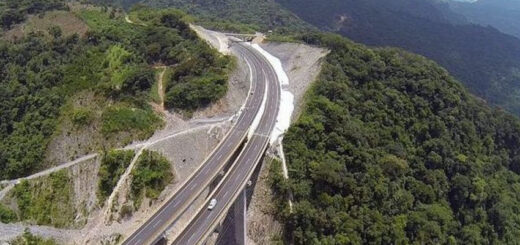
Third: The Mexican government invested significantly in transportation improvements making Puerto Vallarta an easy travel destination. To make Puerto Vallarta accessible by jet aircraft the government developed the City’s international airport. Ground transportation significantly improved. Government invested heavily in the development of highway and utility infrastructure. Another vital improvement for the city was the El Salado wharf (where the current cruise terminal is located), inaugurated on June 1, 1970, making Puerto Vallarta the first harbor town in Jalisco. Improvements and investment in infrastructure led to Puerto Vallarta experiencing tourist booms, starting in the late 1960s. While tourists from the United States and Canada started flowing in, tourists in Puerto Vallarta were principally from Mexico, who started traveling to Puerto Vallarta because the improved infrastructure (4-lane paved highways) made travel easy and convenient (e.g., Guadalajara and Puerto Vallarta).
Fourth: In 1968 the Puerto Vallarta municipality was elevated to City status. The elevation in status reflected interest by Mexican federal and state governments in developing the Puerto Vallarta as an international resort destination. Puerto Vallarta has since also attracted a lively expatriate community from the U.S., Canada and Europe.
Fifth: The City showcased its new image. In August 1970 visit of U.S. President Richard Nixon who met with Mexican then-President Gustavo Díaz Ordaz in Puerto Vallarta for treaty negotiations. The visit showcased Puerto Vallarta’s recently developed international airport and resort infrastructure. The U.S. Presidential visit contributed significantly to getting Puerto Vallarta’s name in the news and visibility as a resort destination.
Sixth: Resort hotel development in Puerto Vallarta boomed in the 1970s. Prior to 1973 hotels in Puerto Vallarta tended to be modest, mid-priced establishments. Only two large sized luxury hotels existed (the Real and the Posada Vallarta). After 1973, Puerto Vallarta experienced rapid growth in global-brand luxury hotels and international resorts, to where in 2013 there are approximately 41 five star and four star rated hotels.
An economic downturn in Mexico caused tourists to flock to Puerto Vallarta. In 1982, the peso was devalued and Puerto Vallarta became a bargain destination for US tourists. Consequently, the mid-1980s saw a marked and rapid rise in the tourist volume. This uptick fueled additional development, for example the Marina which was started in 1986. But Puerto Vallarta’s success caused other Mexican cities to take note. The early 1990s saw Mexico’s government and private business develop other resort destinations, such as Ixtapa and Cancún. This took away Puerto Vallarta’s exclusivity of sorts on the foreign tourist trade, and caused a slump in travel to Puerto Vallarta.
With growth comes problems. During the early 1980s Puerto Vallarta experienced a marked increase in problems related to poverty. While the devaluation of the peso brought record numbers of tourists to the area, it also stifled investment and thus construction. So while more and more workers were arriving in Puerto Vallarta to try to cash in on the booming tourist trade, less and less was being done to accommodate them with housing and related infrastructure.
So during the mid-1980s Puerto Vallarta experienced a rapid expansion of impromptu communities poorly served by even basic public services. This very low standard of living leveled out Puerto Vallarta’s resort boom. In the late 1980s Puerto Vallarta government worked to alleviate the situation by developing housing and infrastructure. However, the legacy of the 1980s boom remains even today where the outlying areas of Puerto Vallarta suffer from poor provision of basic services (i.e. water, sewage, roads).
In 1993, the federal Agrarian Law was amended allowing for more secure foreign tenure of former ejido land. Those controlling ejido land were allowed to petition for regularization, a process that converted their controlling interest into fee simple ownership. This meant that the property could be sold, and it led to a boom in the development of private residences, mostly condominiums, and a new phase of Puerto Vallarta’s expansion began, centered more on accommodating retirees, snowbirds, and those who visited the city enough to make purchasing a condominium or a time-share a cost-effective option.
Tourist Attractions & Sightseeing
Landmarks in Puerto Vallarta
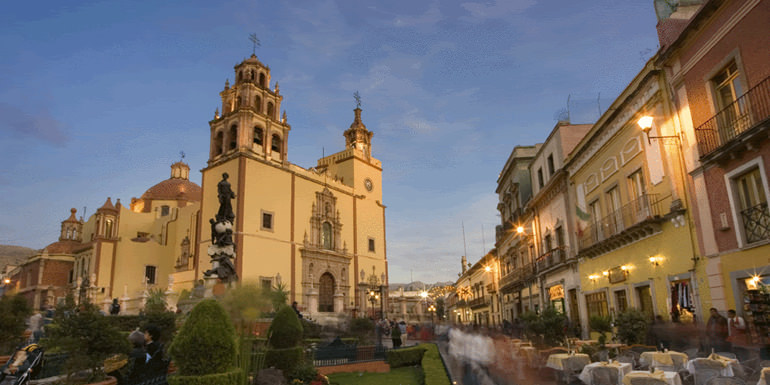
- Church of Our Lady of Guadalupe – Col. Centro
- Púlpito and Pilitas (Pulpit and Baptismal Font) – Col. Emilio Zapata – two rock formations at the South end of Los Muertos Beach. El Púlpito is the tall headland and Las Pilitas are the formation of rocks beneath it. Las Pilitas was the original location of the Boy on a Seahorse sculpture (El Caballito) now located on the Malecón, an identical sculpture is also located on Los Muertos Beach. There are two streets in the Olas Altas area named after the rock formations
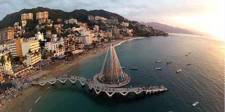
- The Malecón – paved walkway along the seashore in Col. Centro – especially popular during the Sunday evening paseo. It features a collection of contemporary sculptures by Sergio Bustamante, Alejandro Colunga, Ramiz Barquet and others. The Malecon was extensively rebuilt in 2002-2003 following damage from hurricane Kenna. It was also greatly renovated, having new walkways and iconic sculptures in 2010
- Mercado Isle Cuale and Mercado Municipal Cuale – there are two large public markets in the Centro along the banks of the Cuale selling a variety of artisanal and souvenir goods, and the Isla Cuale has a number of souvenir vendor shops as well. The Isla Cuale was also famous for its cat population. The Island was a lower class suburb until flooding during Hurricane Lily (1971) forced residents to be relocated. They were moved to Palo Seco (which means “dry stick”) and the Island was converted into a site for restaurants, shops and a cultural center
- John Huston statue on Isla Cuale – dedicated on the 25th anniversary of the film’s release and honoring Huston’s contributions to the city. John’s son Danny was married in a ceremony that took place at the statue in 2002
- Plaza de Armas (Ignacio Vallarta) / Aquiles Serdan Amphitheater (Los Arcos) – the city’s main plaza – site of public concerts both at the bandstand in the Plaza de Armas and on the stage in front of the arches across the street
Cultural Centers, Museums, Theaters & Cinema
- Cuale Archaeological Museum – on the West side of the Isla Cuale, the museum presents a significant collection of local and regional pre-Hispanic art in a number of informative displays. The museum also houses a small gallery for showing contemporary art
- City Hall – a modern city hall laid out using a traditional courtyard plan. There is a tourist office in the SW corner, and on the landing of the main (West off the courtyard) stairwell there is a modest naive style mural by local artist Manuel Lepe
- Saucedo Theatre Building (Juarez at Iturbide) – Built in 1922 in a Belle Epoque style reminiscent of architecture of the Porfirato. The theater presented live shows and films on its first floor, and the second floor housed a ballroom. The building has been converted to retail use
Spanish Language Schools & Centers
IMAC Spanish Language Programs
We are not just another beach location. Guadalajara is the birthplace to the most iconic symbols of Mexico; Mariachi, Tequila, Mexican Cuisine and Folkloric Traditions. We are The Most Accredited Spanish Language School in Mexico with the most international and national accreditations. Over forty years of language teaching experience.
We offer:
Group and Private lessons
All Inclusive programs
Spanish for proffesionals
Accredited teaching staff
Full details: www.learnspanish.com.mx
Beaches & Water Activities
Beaches in Puerto Vallarta
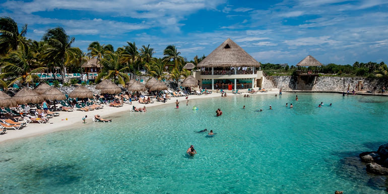
- Playa Conchas Chinas (Curly Shells Beach) – Fracc. Amapas – the city’s most secluded beach, located to the south of the headland which forms the boundary of Los Muertos beach
- Playa Camarones (Shrimp Beach) – Col. 5 de Deciembre (vicinity of Av. Paragua – Hotel Buenaventura. This is the northernmost public beach in the City of Puerto Vallarta proper. It is named after the shrimp fishermen that once landed their launches on the beach to unload their catch
- Playa Olas Altas (High Waves Beach) – Col. Emilio Zapata – the beach extends from the Cuale River South to the fishing pier. In spite of the name, the waves offshore are not particularly high, and the beach is a popular place to swim, especially for locals and national tourists. The beach is lined with outdoor restaurants
- Playa Los Muertos (Beach of the Dead) – Col. Emilio Zapata – the city’s largest public beach. Legend has it the beach’s name (Dead Men’s Beach) stems from a battle between pirates and local miners after which bodies remained strewn on the beach, but it’s a legend, since there were never any miners in Vallarta. The South Side of the beach is a popular gathering spot for gay and lesbian tourists. The North end is frequented mostly by locals, and national tourists. The city has recently tried to change the name of the beach to Playa del Sol
- Playa Boca de Tomates (Mouth of Tomatoes) – a beach located near the mouth of the Ameca River. The beach is not very popular among international tourists due to the rocks that come ashore especially in the summertime. Also watch out for crocodiles. Its proximity to the Ameca River which carries muddy rainwater in the summertime causes the water to lose its clarity making it appear dirty
Beaches South of Puerto Vallarta
- Playa Gemelas – a beach 3 km (2 mi) north of the mouth of the Mismaloya river and has some of the clearest water in the bay
- Playa Mismaloya – at the mouth of the Mismaloya River. The beach was featured in several scenes from Night of the Iguana and the main set was located on hillside to the south of the beach. The beach is developed with a number of restaurants
South Shores beaches
A number of beaches along the South shore of the bay are accessible only by boat (from Boca de Tomatlán or the Los Muertos Pier). The developed beaches include (east to west): Las Animas, Quimixto, Majahuitas and Yelapa. These and other smaller undeveloped beaches can be reached by launch from Boca de Tomatlán.
- Playa Las Animas – a narrow wide white sand beach developed with several restaurants
- Playa Las Caletas – a secluded beach that was once the private retreat of film director John Huston. Today it is a wildlife preserve. There is a living natural reef close to shore which makes the beach a popular destination for snorkelers
- Playa Quimixto – a somewhat rocky and secluded beach which is settled by a small village of a several hundred families. There are horse and guide hire concessions in the town which lead visitors through a small canyon behind the town to a series of waterfalls
- Yelapa – once a small electricity free fishing village and a popular “hideaway” for gringos, now it has electricity, telephones and the internet. Visited by tourist boats for about 3 hours a day, it reverts to its laid back ways when they leave
Beaches north of Puerto Vallarta
The north shore of the bay is lined with beach towns that offer good wading beaches and the usual tourist amenities. These include (east to west): Bucerias, Cruz de Huanacaxtle, Playa la Manzanilla, Playa Destiladeras, Playa Pontoque, and Punta Mita, all in the State of Nayarit. All can be reached by bus (departing from Wal-Mart).
Nearby Tourist Attractions
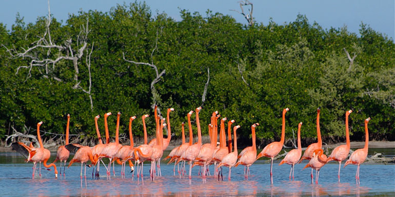
- Los Arcos Marine Natural Area – offshore of Mismaloya 12 km south of Puerto Vallarta. The area has been a National Marine Park since 1984. The area is protected as a breeding ground for pelicans, boobies and other sea birds. The park is a popular snorkeling destination both for the rocks themselves and for the fossilized coral beds that surround them
- Vallarta Botanical Gardens – A popular showcase of orchids, agaves, cactus, palms, and other native plants. A restaurant and river swimming is also available to visitors. The gardens are located 14 mi (23 km) South of Puerto Vallarta on Highway 200. Buses for the Vallarta Botanical Gardens depart from the corner of Carranzas and Aguacate Streets in the Zona Romantica and are labeled as both “El Tuito” and “Botanical Gardens”
- Puerto Vallarta Zoo – with 350 animals, and located in a forested setting in Mismaloya
University of Guadalajara’s Coastal Center – North of Pitillal and West of Ixtapa, the campus features several public attractions including the Peter Gray Art Museum and a Crocodile Farm.
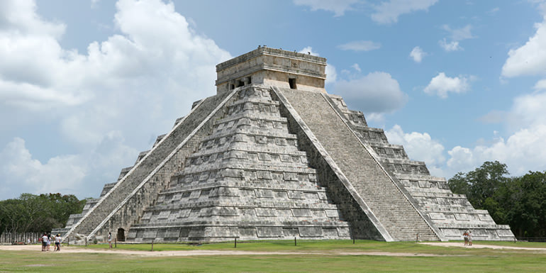
Ixtapa Archaeological Zone – north of the town of Ixtapa along the banks of the Ameca River there is an archeological site with remains going back several thousand years. The site comprises 29 mounds. The largest measures 40 meters in diameter and 8 meters in height. The site also includes the remains of ceremonial ball court. The original inhabitants of the site were vassals of the Aztatlán kingdom which was located in Western Jalisco between 900 and 1200 AD. The site is the oldest explored in Western Jalisco. The digs have uncovered a number of residential and ceremonial sites, a wealth of pottery (incense burners, bowls, amphora, etc.). Many of these objects are on display at the Rio Cuale Island Museum.
Terra Noble Art and Healing Center – a New Age spa, meditation center and artist retreat on the hills east of Puerto Vallarta along the edge of the Agua Azul Nature Reserve overlooking Bahía de Banderas. The complex, built to resemble an early Mexican wattle and daub home was created by architect Jorge Rubio in conjunction with American sculptor Suzy Odom.
Did you know?
The Night of the Iguana (1963) was filmed on location at Mismaloya and other minor locations in the Puerto Vallarta area. The filming brought Richard Burton, Ava Gardner, Deborah Kerr, Tennessee Williams, and Elizabeth Taylor (who was not in the film). The off-screen activities of Burton and Taylor were reported in the tabloids and tabloid newsreels of the day. After filming was completed, Elizabeth Taylor and Richard Burton bought a house in Puerto Vallarta and visited the city regularly while they were married. John Huston decided to build a home in the vicinity, a home on remote Las Caletas beach and a house in town. John Huston’s children Anjelica Huston and Danny Huston are founders and supporters of the Puerto Vallarta Film Festival. (In the film, children are shown selling iguana meat by the roadside. The iguana was once an important food animal, popular in Jalisco and Colima.)
Herbie Goes Bananas (1980) is the fourth of a series of films made by Walt Disney Productions starring Herbie, a white, anthropomorphic 1963 Volkswagen Beetle race car. The film stars Cloris Leachman and Harvey Korman.
Predator (1987) features jungle scenes which were filmed in the hills behind Mismaloya. The film starred Arnold Schwarzenegger and was directed by John McTiernan. McTiernan lost quite a bit of weight during the filming because he was afraid to eat the local food. The cast also endured dangerous obstacles in the jungles such as changing weather, cold water and wildlife.
Perfect Target (1997) action film starring Daniel Bernhardt is filmed also in the city.
Puerto Vallarta Squeeze (2004), a filmed version of the Robert James Waller novel of the same name, was shot on location in and around Puerto Vallarta. It stars Scott Glenn and Harvey Keitel.
Limitless (2011) features a car scene driving through downtown Malecon.
Puerto Vallarta is The Love Boat’s (1977-1986) final port of call.
Beverly Hills Chihuahua (2008) has some scenes filmed in Vallarta.
The low-budget monster flicks, Dinoshark and Sharktopus, have their respective creatures primarily attacking in Puerto Vallarta.
Gastronomy & Cuisine
Local food specialties
- Huachinango Sarandeado – red snapper marinated in a birria paste (roast peppers, garlic and spices) and grilled
- Grilled Mahi-mahi – served on the beaches and at some taco stands – the meat is skewered and cooked over coals then served with hot sauce and lime
- Ceviche – raw fish, scallops, or shrimp, with onions, chiles such as serranos or jalepenos, and lime juice The lime juice cures the fish, turning the flesh opaque and giving it a chewy texture. The ceviche is usually served with tortilla chips or on a whole tostada, and quite frequently accompanied by guacamole
Traditions, Holidays & Festivals
Flower and Garden Festival (last week of February) – A week of tours, classes, and workshops at the Vallarta Botanical Gardens. Dozens of plant, garden, flower, and local craft vendors feature their products and knowledge.
Electro Beach Puerto Vallarta (42-day festival starting in the beginning of March) – An Electronic Dance Music (EDM) festival.
May Festival (last week of May and first week of June) – commemorating the anniversary of the municipality. The festival features outdoor concerts, artistic expositions, sporting events and a parade.
Día de Muertos – Day of the Dead (November 2) – A day of honoring the dead in full Mexican Tradition held at the Vallarta Botanical Gardens. Workshops on making catrina skeleton dolls and cempasúchil (Tagetes erecta) flower arrangements are followed by celebrations in the Garden of Memories and a bonfire dance.
Las Posadas (December 20) – An evening of candlelight caroling & processions to handmade nativities is hosted by the Vallarta Botanical Gardens. Poinsettias and native Mexican pines are also featured during the celebrations.
December 1 to 12 – Festival of the Virgin of Guadalupe.
Spanish Language Schools & Centers
Contact us if you want to add your business or services to our listing.
How to get there & Transportation
The Lic. Gustavo Díaz Ordaz International Airport comprises a commercial international section and a general aviation section.
The commercial section has a single runway, 3,300 m (10,700 ft) in length and 46 m (150 ft) in width, capable of handling all current traffic without restrictions. The airfield is capable of handling 40 takeoffs or landings per hour. The airport terminal has 16 active gates, with an additional six under construction in a terminal extension project as of August 2011.
As of 2011, the active airlines utilizing the commercial section were: Aeromexico, Air Canada, Air Transat, Alaska Airlines, American, Delta, Interjet, Magnicharters, US Airways, United Airlines, VivaAerobus, Volaris, and WestJet.
There are two distinct air traffic patterns in Puerto Vallarta; international and domestic. The international passenger traffic accounts for 73% of Puerto Vallarta’s air passengers peaking January through March at around 570,000 passengers per month. The domestic passenger traffic accounts for 27% of all passengers with a high season during the summer months of July and August peaking at around 222,000 passengers per month. These diverse traffic patterns are similar to other vacation destinations in Mexico.
Annual passenger volume in Puerto Vallarta dropped 20% after the 2009 H1N1 scare from a peak of 3.281 million passengers in 2008 to 2.645 million passengers in 2009.
The general aviation section handles small planes leaving for San Sebastian del Oeste, Mascota, and other towns in the Sierra and along the Coast. It has 18 loading positions and shares the commercial airfield.
Cruise ships
The port of Puerto Vallarta receives cruise ships on a regular basis during the tourist season. The docks (Muelle de Cruceros Puerto Vallarta) can berth three cruise ships simultaneously. Trips to the El Centro old town and its beach front and tourist markets, including some art stores, are available. The beach front has been recently undergoing additional improvements to the Malecon, a long promenade along the beach with numerous sculptures, restaurants, night clubs, access to boat pulled paragliding over the bay, and various other tourist specific activities and markets.
Bus station and regional buses
National bus lines connect Puerto Vallarta (via the Central Camionera near the Modelo building north of town near the airport) with Guadalajara, Mazatlán, Manzanillo and points beyond. Bus lines include ETN and Primera Plus. Smaller bus lines connect Puerto Vallarta to small coastal and sierra towns.
Rail
Puerto Vallarta currently has no passenger rail service. Historically, buses connected with nearby Tepic, where there was a passenger rail service on the main north-south trunk of Ferromex. Heading north, trains continued to Nogales, opposite its namesake in Arizona. A spur headed northwest to Mexicali, opposite Calexico, California. Service to the east went to Guadalajara and then to Mexico City.
Local transportation
Puerto Vallarta is serviced by three municipal bus unions that provide coverage for most of the greater Puerto Vallarta area (e.g. Ixtapa, Mismaloya, Pitillal). Most of the population of the Municipality of Puerto Vallarta travels by municipal bus. Automobile ownership is not rare, but cars are seldom used to commute to and from work. They are typically reserved for family outings and major shopping trips. Parking in Puerto Vallarta is scarce, and this makes automobile commuting impractical.
Throughout the central area of the city and along the coastal strip, roads are generally paved, often with cobblestones. In the residential areas outside of the central commercial area dirt roads are the norm, and many of them are in poor condition and not suitable for normal cars except at very low speeds.
The city is also served by a large fleet of taxis. Rates are controlled by a taxi driver’s union, and set in negotiations between the union and the city. Rates are based on established zones rather than using taxi meters.
Tourist Assistance + Emergency Numbers
You can dial 078 from any phone, where you can find free information about tourist attractions, airports, travel agencies, car rental companies, embassies and consulates, fairs and exhibitions, hotels, hospitals, financial services, migratory and other issues.
Or dial the toll-free (in Mexico) number 01-800-006-8839.
You can also request information to the email correspondencia@sectur.gob.mx
MORE EMERGENCY NUMBERS:
General Information: 040 (not free)
National Emergency Service: 911
Radio Patrols: 066
Police (Emergency): 060
Civil Protection: +52(55)5683-2222
Anonymous Complaint: 089
Setravi (Transport Mobility): +52(55)5209-9913
Road Emergency: 074
Cruz Roja: 065 o +52(55)5557-5757
Firefighters: 068 o +52(55)5768-3700
Let us know if this article was useful for you