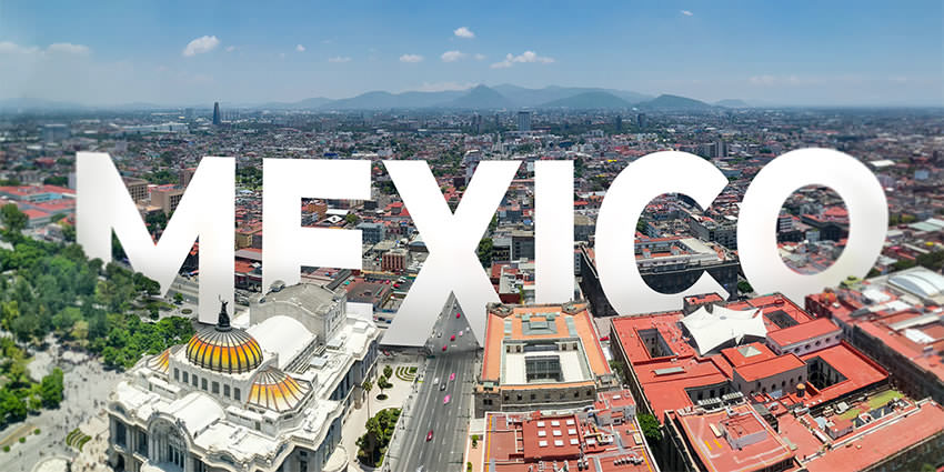
Chihuahua
The city of Chihuahua is the state capital of the Mexican state of Chihuahua.
Chihuahua is best described as shaped as a large letter L, with plains to the north and hills on both sides, as well as the south; it is crossed east-and-west by Teofilo Borunda Avenue, which follows the natural flow of the Chuviscar River. Borunda is crossed in the west by the Periferico de la Juventud, a major limited-access highway running north-and-south. The main entrance to the city from the north (from the direction of Ciudad Juárez) is Tecnològico Avenue, part of the Pan-American Highway.
It has a population of about 925,970. The predominant activity is industry, including domestic heavy, light industries, consumer goods production, and to a smaller extent maquiladoras.
Geo & Climate
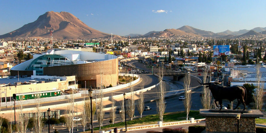
The geography of the city is dominated by three hills that appear in the Coat of Arms: Cerro Grande, Cerro Coronel and Santa Rosa, the last of which is fully covered by the city. The Cerro Grande has a monumental cross that is lighted each Christmas.
To the east and northeast, is the Sierra Nombre de Dios, across the Sacramento River from the city. Contained therin, off of Heroico Colegio Militar Ave, are the Nombre de Dios Caverns, a beautiful natural display of minerals and underground formations. To the far east and south is General Roberto Fierro Villalobos International Airport and the highway to the US-Mexican border crossing at Presidio, Texas and Ojinaga, Chihuahua.
Chihuahua lies on the western side of the Chihuahuan Desert ecoregion and as such has a semiarid climate (Köppen climate classification BSh). However, it is not as hot as most of the lower elevated portions of the desert to the east owing to an altitude of almost 1,500 metres (4,900 feet) above sea level.
Winters are mild with an average daytime temperature of 17 °C (62.6 °F) and an average minimum temperature of 2 °C (35.6 °F) in January, the coldest month. Occasionally, temperatures can exceed 26 °C (78.8 °F) while cold fronts can push it below −10 °C (14.0 °F). Frosts are common during winter nights. During this time of the year, the climate is dry, with an average humidity around 46% and many days are sunny, averaging 15–18 clear days. Precipitation is rare, with only 1 or 3 days with measureable precipitation from December to March. Snowfall is somewhat uncommon in the city, normally with 2 snowfalls a year, although the surrounding area may receive three or four snowfalls.
Summers are hot with June being the hottest month, averaging 33 °C (91.4 °F) during the day and 19 °C (66.2 °F) during the night. Temperatures can easily exceed 32 °C (89.6 °F) on most days and it can occasionally exceed 38 °C (100.4 °F). Most of the precipitation falls during the summer months, when the monsoon moves up northwards, causing moist air from the Gulf of California and the Gulf of Mexico to move into the city. Afternoon storms are common during the monsoon season and they can be accompanied with hail and thunderstorms. The days are still warm to hot in July and August, though slightly cooler due to the presence of the rain, with an average high of 30 °C (86.0 °F). Humidity is also higher during this time, averaging 53%.
March, April, October and November are transitional months that are unpredictable. Temperatures can reach up to 38.5 °C (101.3 °F) in April while cold fronts can push it below freezing. Usually, these months have warm days, averaging 22 °C (71.6 °F) to 28 °C (82.4 °F) and cool nights (around 5 °C (41.0 °F) to 11 °C (51.8 °F)). During the months of March and April, there can be strong winds that cause dusts and sandstorms.
The National Weather Service of Mexico (Servicio Meteorologico Nacional) reported that the warmest temperature ever recorded in the city is 41.6 °C (106.9 °F), while the coldest is −18 °C (−0.4 °F) on February 4, 2011. July 1973 is the record wettest month, with 242.5 millimetres (10 in). For a single day the record rainfall is 89.0 millimetres (4 in) on August 24, 1966. Chihuahua averages 3,081 hours of sunshine per year, ranging from a low of 217 hours in December (about 7 hours of sunshine per day) to a high of 305 hours in May (about 9.8 hours of sunshine per day).
Origin of the Name
It has been said that the name derives from the Nahuatl language, meaning “between two waters”, other accepted definitions are “place of the holed-rock” ” or from Tarahumara, “dry and sandy place”.
History
The city was founded on October 12, 1709, by Blas Cano de los Rios and Antonio Deza y Ulloa, a Spanish explorer, as El Real de Minas de San Francisco de Cuéllar. Don Ildefonso de Irigoyen donated the land for the city foundation. The town was erected a Villa in 1718 (or 1715) with the name of San Felipe el Real de Chihuahua, and the name was shortened in 1823. The location was chosen because it is the intersection of the rivers Chuviscar and Sacramento. It is also the midpoint between the Río Bravo del Norte (Rio Grande) and the then-important mining city of Hidalgo del Parral. For much of the 18th century, Chihuahua served as the de facto capital of Nueva Vizcaya because most governors preferred to reside there rather than in Durango, the capital of the province at that time.
Just as in other parts of Northern Mexico, Roman Catholic missionaries were an important influence during the colonial era, and the city became a meeting point for missionaries heading to and from the ‘sierra’, the mountainous region in western Chihuahua State where the native Tarahumara still live.
During the War of Independence, the city saw little action. However, it was in Chihuahua where Miguel Hidalgo, considered the Father of the Country, was held prisoner in the Federal Palace of Chihuahua and executed in 1811 at the nearby Government Palace by the Spaniards.
During the Mexican-American War, Chihuahua fell to U.S. forces in 1847, after the Mexican Army was defeated at the Battle of the Sacramento, 15 miles (24 km) north of the city.
During the French invasion, President Benito Juárez made the city the seat of his government-in-exile from 1864 to 1867. During the presidency of Porfirio Díaz the city experienced explosive growth and became one of the most important cities in Mexico. The city became the seat for important banks and wealthy families.
The city was more involved during the Mexican Revolution (1910–1917), for it became at times the operations base for the División del Norte, the army led by Pancho Villa. Many sites and memories remain of the Revolutionary era; the most important of these is the Historical Museum of the Mexican Revolution at Villa’s former estate house near downtown Chihuahua. La Quinta Luz was turned into a museum by his widow, Sra. María Luz Corral de Villa, and is now managed by the federal government.
During the 20th century, the city grew in population and learned to take advantage of its proximity with the U.S. border. Until the establishment of foreign manufacturing plants in the 1970s, the city was largely a trade post for cattle and agricultural products.
During the 1990s the city grew dramatically economically, becoming the third wealthiest municipality (per capita) in the republic, after Benito Juárez borough of the Federal District (Mexico City), and San Pedro Garza García in Nuevo León.
Between 2002 and 2005, the city experimented with the introduction of certain new commercial innovations, like the first large mall in the city, Plaza del Sol, and the rise of the commercial Zone of the Sun, all along the Periférico de la Juventud, one of the main thoroughfares in the city.
Since 2005, the International Festivals of Chihuahua have been celebrated by both the state and city governments during the months of September/October with art shows, plays, stage presentations and concerts by such bands as America, Foreigner, Creedence and Los Lobos being held at venues throughout the city.
The city of Chihuahua offers many places of interest for the tourist, especially the history buff (see Museums of Chihuahua), including the baroque Metropolitan Cathedral, seat of the Archdiocese (and the resting place of St Peter of Jesus Maldonado, a Cristero martyr of the 1930s), dating from the 18th century, the Government Palace from the early 19th century, and the City Hall from the turn of the 20th century, on the Plaza de Armas across from the Cathedral.
During the French invasion and the Second Empire, which ended with the execution of the Habsburg Emperor Maximilian in 1867, the constitutional president, Benito Juárez García traveled the country, searching for support wherever he could. He found it in 1864 when he settled his cabinet and government-in-exile here in the city at the address now known as Ave. Juárez 321, and incidentally, making Chihuahua the only city, aside from Mexico City, to be the capital of the Republic. The Museo Casa Juarez, now known as The Museum of Republican Loyalty, has been faithfully restored to the appearance it had when President Juárez lived here from 1864 through 1866.
The city offers the service of the touristic “Trolley el Tarahumara” which is a special bus that goes around to all the main museums and monuments in the City Centre(starting its route at the Plaza de Armas), including parks like the Central Park “El Palomar”, a large park that has a collection of sculptures, including one depicting three doves (palomas, hence the park’s name) and a monumental flagpole, flying one of the largest flags in the Republic, as well as a statue of one of Chihuahua’s favourite sons, the late actor Anthony Quinn, in his famous role as ‘Zorba the Greek’, as well as many others. The city is renowned for its classical and modern sculpture, as seen on any main boulevard or avenue. Included are works by Espino, Baltazar, Ponzanelli and Sebastian, the latter being a native of Chihuahua.
Particularly noteworthy are the murals in the Government Palace and the Paraninfo, or University Auditorium (in the Literary and Scientific Institute building) both depicting the history of the State of Chihuahua, and both fronting upon the Plaza Hidalgo in the city centre, and catter-cornered from the Plaza Mayor. Also of note is the Quinta Gameros, one of the largest estate houses in pre-revolutionary Chihuahua City, now the state museum for the decorative arts, and the former Federal Palace of Chihuahua on Venustiano Carranza Street, north of the Government Palace, which is now a museum and contains the cell in which Miguel Hidalgo spent his final days, and is a national shrine.
The Plaza Mayor is an important square in the city centre that displays fountains, green spaces and a collection of monuments depicting local heroes. The main monument in the Plaza Mayor is the “Ángel de el Libertad” that was built in 2003 representing the freedom of all Mexicans, especially Chihuahua’s people. It was inaugurated during the Independence Day festivities on September 15 of that same year. The angel has a sword with a laser light at the tip, and is capable of rotating 360° over its axis.
The Mammoth Museum, at Gomez Morin (also Calle 27a) and Ave. Juarez, is the city natural history museum and contains 13 halls detailing prehistoric life from the dinosaurs through the reign of the mammals, or the Cenozoic Era. It also has exhibits of prehistoric art. The Semilla Museo Centro de Ciencia y Tecnología, or Seed Centre Museum of Science and Technology, on Teofilo Borunda and Lisboa in the City Centre, is a creative learning centre and interactive science museum for children.
***
Even though Chihuahua suffered a massive destruction of colonial buildings during the 1970s in order to widen the main streets and avenues in the downtown, it stills preserves some valuable monuments from the 19th and 20th centuries. Some of the more interesting sites in the city are listed below:
- Temple of San Francisco, commenced 1717 and completed in 1789-The original burial place of Fr Miguel Hidalgo
- Federal Palace of Chihuahua, now a museum, and the jail cell of Fr Hidalgo
- Museo Casa Juarez, also called The Museum of the Republican Loyalty, is the house where President Juarez lived during his time at Chihuahua City
- Central Park “El Palomar”-Once one of the worst slums in the city, now the largest city park
- Mansion Creel
- Mansion Terrazas
- Mansion ‘Quinta Carolina’ (Former summer estate of Don Luis Terrazas; see Creel-Terrazas Family.)-Now in semi-ruined condition, in process of restoration
- Torre Legislativa de Chihuahua (Legislative tower of Chihuahua-state legislators office building) -Fronts on the Plaza de Armas
- The Government Palace (The State House)
- City Hall
- Dancing Fountains north of the Federal Palace
- Mansion ‘Quinta Gameros’ (City Museum for the Decorative Arts)
- Church of Santa Rita (1731). St Rita of Cascia is the patroness of the city
- Ave. Zarco Residential Area (Some of the most impressive pre-revolutionary residences in the city are situated along this street)
- Colonial Aqueduct-lengths still exist of this monument which was built to transport water from mountain springs to the villa
Parks
- El Palomar
- Ciudad Deportiva
- Deportiva Sur
- Parque metropolitano el rejon
There are two country clubs
- San Francisco Country Club
- Campestre Chihuahua
Most U.S. franchise restaurants and fast-food establishments will be found in Chihuahua, mostly on the Periferico de la Juventud, north of downtown on Universidad Avenue, or on Libertad Street Pedestrian Way in the city centre, and are patronised by the city’s youth and young professionals.
Nightlife
The nightlife is lively, especially in the city centre, where some of the large, pre-revolutionary estate houses have been turned into nightclubs and dance halls, many featuring the best of Chihuahua’s live bands.
How to get there & Transportation
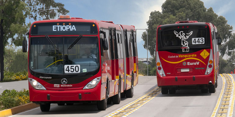
Chihuahua is served by Roberto Fierro Villalobos International Airport (IATA Airport code: CUU). It is the starting point for the Chihuahua–Pacific Railroad, and is also served by Ferromex, a private Mexican railroad. There is a large central depot for intercity buses in the south side of the city. For transportation within the Chihuahua metropolitan area, a network of buses exists but is of very poor quality; the city does not provide a map of routes or operating hours. The system of avenues and main streets in the city is being constantly revamped, with the construction of new roads and bridges to handle the ever-increasing traffic.
Important highways that run through Chihuahua are highway 45, which connects Chihuahua to Ciudad Juarez to the north and Delicias to the south, and highway 16, which connects Chihuahua to Hermosillo to the west and to the border town of Ojinaga to the east.
Traditions & Festivals
The Feria (Fair) of Santa Rita, known throughout the Republic, is held during the last two weeks of May and features internationally known recording artists in concert. The fair has been held annually for decades. In addition, the University Symphony performs at the Paraninfo weekly during the summer months, and features international guest artists in classical and pop concerts. The Plaza de Toros, or bull ring, ‘La Esperanza’ is located on Teofilo Borunda on the north side of the river, and features Corridas (Bullfights) during the summer and fall.
Tourist Assistance + Emergency Numbers
You can dial 078 from any phone, where you can find free information about tourist attractions, airports, travel agencies, car rental companies, embassies and consulates, fairs and exhibitions, hotels, hospitals, financial services, migratory and other issues.
Or dial the toll-free (in Mexico) number 01-800-006-8839.
You can also request information to the email correspondencia@sectur.gob.mx
MORE EMERGENCY NUMBERS:
General Information: 040 (not free)
National Emergency Service: 911
Radio Patrols: 066
Police (Emergency): 060
Civil Protection: +52(55)5683-2222
Anonymous Complaint: 089
Setravi (Transport Mobility): +52(55)5209-9913
Road Emergency: 074
Cruz Roja: 065 o +52(55)5557-5757
Firefighters: 068 o +52(55)5768-3700
Let us know if this article was useful for you