Tampico
Tampico is a bustling city located in the northeastern part of Mexico, in the state of Tamaulipas. Tampico is the 5th-largest city in Tamaulipas, located on the north bank of the Pánuco River, 10 km inland from the Gulf of Mexico.
Situated along the Gulf of Mexico, Tampico boasts a strategic location for trade and tourism. It’s about 330 km south of the Texas border, making it easily accessible for visitors from the United States.
Tampico is a port city, with the Pánuco River flowing through it into the Gulf.
Tampico’s geography is characterized by a coastal plain that gradually rises into low hills further inland. The city itself is situated on a narrow strip of land between the Pánuco River and the Gulf of Mexico.
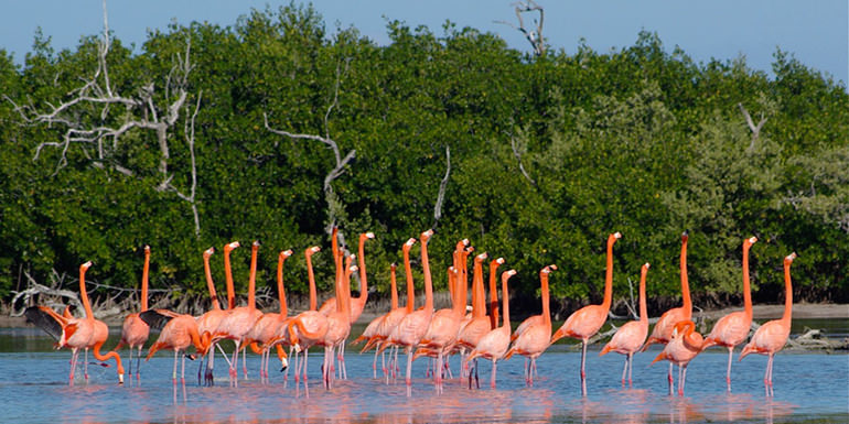
This geographical setup has made it a hub for maritime trade and activities. The lush vegetation around Tampico includes mangroves, which serve as important ecological zones and provide a unique environment for various bird species and marine life.
Tampico’s environment is influenced by its proximity to the Gulf, making it a coastal haven. The city’s economy is closely tied to its natural resources, with oil extraction being a major industry in the region.
Tampico is surrounded by rivers and lagoons of the delta of the Pánuco River, which was the habitat of a large population of otters.
Geo & Climate
Tampico has a tropical savanna climate, with an average temperature of 18 °C for January as well as precipitation patterns. Its weather, though reasonably pleasant in spring and autumn, is hot in the summer.
The average high reaches 32°C in August, with an average low of 23°C.
Winters are pleasantly cool, the average January high is 23°C and the average low in January is 15°C.
Rainfall is frequent from May through September.
Tampico is an extremely humid city, with summer heat indices reaching 40°C.
Tampico is located among extensive wetlands adjacent to the Gulf of Mexico. During autumn and winter, it is affected by cold fronts that pass through the gulf and bring high winds that can reach 50 km/h with gusts of 70 to 80 km/h.
Tampico is also located in a hurricane area, but it has not been directly affected by 1 in more than 50 years.
On rare occasions, the city experiences surprisingly low temperatures for its zone, during late January and early February 2011, a cold wave caused temperatures to drop to 10°C, with the lowest being 2°C in the morning and noon of 4 February.
In February 1895, snow was reported to have fallen in Tampico. This is the North American record for the furthest south report of snow at a coastal location and makes Tampico one of the few places where snow has fallen in the tropics at sea level.
The best time to visit Tampico
The ideal time to visit Tampico largely depends on your preferences. If you prefer milder weather and fewer crowds, consider planning your trip during the dry season, from November to April.
During this period, you can enjoy outdoor activities like exploring the city’s historic center, strolling along the waterfront Malecón, or visiting local beaches without worrying about heavy rain.
On the other hand, if you’re a fan of lush greenery and don’t mind occasional rain, the wet season offers a different charm. The vegetation is at its prime during these months, and you’ll find Tampico’s natural beauty in full bloom.
In conclusion, Tampico is a diverse and vibrant city with a rich cultural and natural heritage. Its strategic location, unique geography, and contrasting climate seasons make it a year-round destination for travelers.
Origin of the Name
The name “Tampico” is of Huastec origin, tam-piko meaning “place of otters” (literally “water dogs”).
History
There have been successive human settlements in the area for centuries. The region had several early Huastec settlements, among them the important site at Las Flores, which flourished between AD 1000 and 1250.
In 1532, during the Spanish colonial period, the Franciscan priest Andrés de Olmos established a mission and monastery in the area, building over a former Huastec village.
At his request, Spanish officials founded a settlement named San Luis de Tampico in 1554.
This site was abandoned in 1684 and the population relocated to the south of the Pánuco River because of frequent attacks by European and American pirates. The area was abandoned for nearly 150 years.
The present Mexican city was founded on April 13, 1823, on the north bank of the Pánuco River about 10 km from the Gulf, after Mexico achieved independence from Spain.
Tampico built its economy on the exportation of silver; business development was mostly as a trading center and market town of an agricultural region. The town also became a common waypoint for the re-routing of African slaves to be illegally smuggled into the Southern United States, which had outlawed the international slave trade in 1807.
In August 1829, Spain sent troops from Cuba to invade Tampico in an effort to regain control of the region, but in September, General Antonio López de Santa Anna forced the Spanish troops to surrender, and Mexican control of Tampico was re-established.
20th century to present
During the period of Mexico’s first oil boom in the early 20th century, the city was the “chief oil-exporting port of the Americas” and the 2nd-busiest in the world, yielding profits that were invested in the city’s famous architecture, often compared to that of Venice and New Orleans.
The first oil well in Mexico was drilled near Tampico in 1901 at Ébano.
In 1923, the major oil field dried up, leading to an exodus of jobs and investments, but economic development in other areas made the city a pioneer in the aviation and soda industries.
The city is also a major exporter of silver, copper, and lumber, as well as wool, hemp, and other agricultural products. Containerized cargo is mainly handled by the neighboring ocean port of Altamira.
The first oil well in Mexico was drilled near Tampico at Ébano S.L.P. in 1901, by Californian Edward Doheny, who founded Mexican Petroleum Corporation. In the early 20th century, there was extensive U.S. investment in oil development in Tampico, with a sizable United States expatriate community developing in relation to the industry.
With the outbreak of the Mexican Revolution, which lasted roughly from 1910 to 1920, the U.S. monitored the situation to protect its citizens and investments. Doheny sold some of his businesses to the Standard Oil Company which operated its monopoly here.
The oil-producing area was so productive it was called the “Golden Belt”.
The oil fields known as Ébano, Pánuco, Huasteca, and Túxpan are all situated within a 160-kilometre radius of the city.
Oil was often shipped on barges along the rivers. To improve the transportation of oil to the port, the government built the Chijol Canal, beginning in 1901. It is 1.8 m deep and 7.6 m wide and runs 120 km southward through the oil fields to Túxpan.
During the Mexican Revolution, on April 9, 1914, 10 Mexican troops and nine U.S. Navy sailors from the USS Dolphin confronted each other in a failure to communicate as U.S. forces tried to get fuel supplies.
General Victoriano Huerta’s forces in the city were threatened by different groups from both north and south.
The Americans were arrested and later freed, but the U.S. resented Huerta’s demands for some recognition. In the resulting Tampico Affair, the U.S. sent naval and marine forces into Veracruz and occupied the city for seven months in a show of force.
Due to resulting anti-American demonstrations on each coast, other U.S. Navy ships were used to evacuate some American citizens to refugee camps in southern U.S. cities.
The U.S. occupation contributed to the downfall of Huerta, and Venustiano Carranza became president. He ensured that Mexico maintained neutrality during World War I, in part due to lingering animosity against the U.S. for these actions.
In the 1970s, Tampico annexed the port city and suburb of Ciudad Madero, which now comprises part of the Tampico metropolitan area. Tampico has a modern port with excellent facilities, as well as rail and air connections to Mexico City and the United States.
The Mexican government nationalized the oil industry in 1939 and has maintained that for 75 years.
In November 2014, President Enrique Peña Nieto announced a policy change of ending Pemex’s monopoly and inviting private companies back into the oil and gas industry. While analysts believe the largest finds are likely to be offshore, new techniques may yield oil even at mature fields such as those of Tampico.
In early 2015, the government planned to accept bids on 169 blocks, 47 of which are within 110 km of Tampico.
It is expected that smaller companies will be active in the mature fields, such as those in this region. This area has extensive shale oil deposits, and the “U.S. Energy Information Administration estimates that Mexico has the world’s eighth-largest shale oil resources.”
Tourist Attractions & Sightseeing
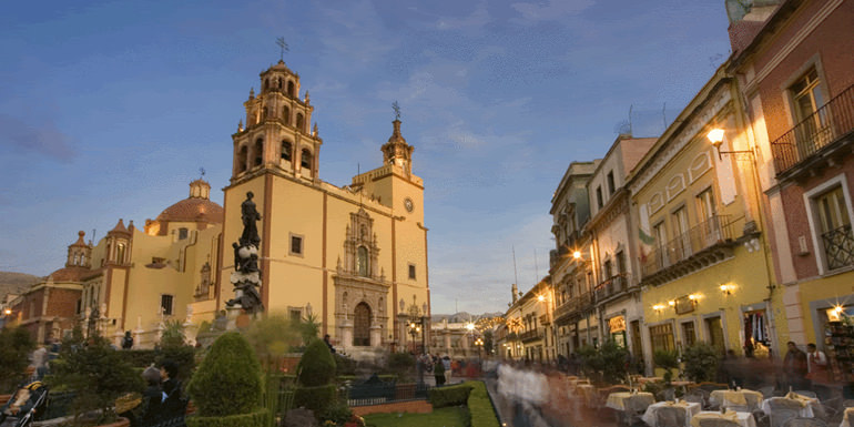
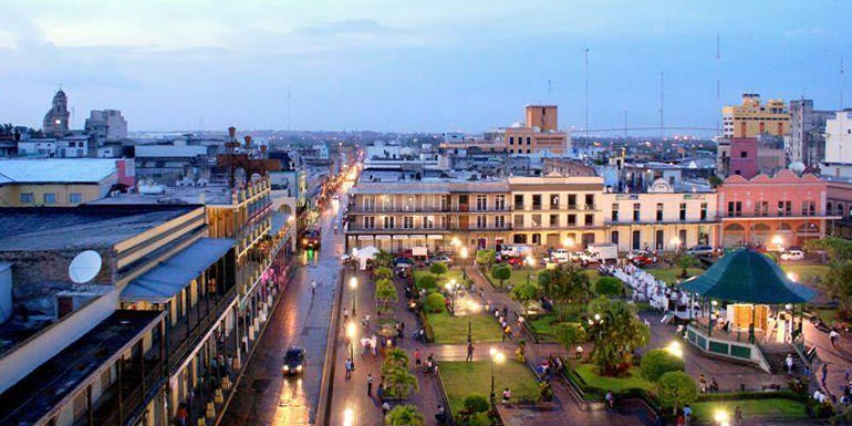
Tampico’s downtown architecture is an eclectic mix, reflecting the growth of the city during the Porfiriato (the period of rule by President and dictator Porfirio Díaz).
During the oil boom of the first decades of the 20th century, much “grandiose” architecture was built, inviting comparisons with Venice, Italy, and New Orleans in the United States.
Many buildings feature wrought-iron balconies (in the 20th century, these were mostly built of English cast iron).
Similar balconies are characteristic of the French and Spanish-influenced architecture in New Orleans. Some of the balconies in Plaza de la Libertad bear the original plaques showing their manufacture at the Derbyshire forge of Andrew Handyside and Company.
Notable buildings include the neoclassical Town Hall in Plaza de Armas and the English redbrick Customs House in the docks.
The prevalence of New Orleans-style architecture is attributed to the oil boom years.
Not only was there money to spend, but many building supplies, including pre-built housing components, were shipped from New Orleans to this area during that period of rapid development.
The historical downtown areas of Plaza de Armas and Plaza de Libertad have been restored and improved in recent years to emphasize their historic appeal, in part to encourage more heritage tourism.
The Cathedral of Tampico, also known as the Temple of the Immaculate Conception.
It is located in Plaza de Armas, and dates to the late 19th century. It has undergone several restorations. It is of the neoclassical style in light brown canter, with Corinthian-style columns and three enormous doors that form the entrance.
Its two towers are made of three bodies. The eastern one has a large, London-made, public chiming clock, a gift from Don Angel Sainz Trapaga. Its recently refurbished interior holds several wall paintings and other works of art.
The altar is of white Carrara marble.
The United States oil tycoon Edward Doheny of California, who drilled the first oil well in Mexico near Tampico, donated substantial funds for the Cathedral’s construction and maintenance after 1902 when he based his Mexican oil operations in Tampico.
Gastronomy & Cuisine
Seafood is important in the city. The locals are informally known as Jaibas (crabs), and the crab emblem is seen in many places, from sports logos to the sides of buses to park benches.
In popular culture
- American writer Joseph Hergesheimer’s 1926 novel Tampico tells a tale of USA expatriates living in the city.
- “Tampico” is the title of a 1945 song composed by Allan Roberts and Doris Fisher and produced by jazz musician and conductor Stan Kenton, with lead vocals by June Christy. Roberts suggested in his song that the city had become more American than the U.S. itself.
- American director John Huston set the opening scenes of his 1948 motion picture epic The Treasure of the Sierra Madre in Tampico.
- American singer Jimmy Buffett wrote the song “Tampico Trauma” about experiences in the city.
- Episode 33 of the U.S. television series Maverick is set in the city and titled “Escape to Tampico”.
- The novel Tampico’s Gold by Elizabeth Braun describes Tampico in poetic detail.
- Tampico is the name of a popular brand of juice concentrates, carbonated beverages, and iced teas based in the United States.
- Tampico is mentioned in the song “Le général a dit” (“The general has said”) recorded by French singer-songwriter Joe Dassin.
- “Tampico” is a 1975 song by Swedish singer-songwriter Eddie Meduza, from his first album, Errol.
- Tampico is a key setting in Country of the Bad Wolfes, a 2012 historical novel by James Carlos Blake.
Transportation
The metropolitan area of Tampico, Ciudad Madero, and Altamira is served by General Francisco Javier Mina International Airport (IATA airport code: TAM), which is located in the northern part of the city of Tampico.
Tampico Airport has international daily flights to the USA.
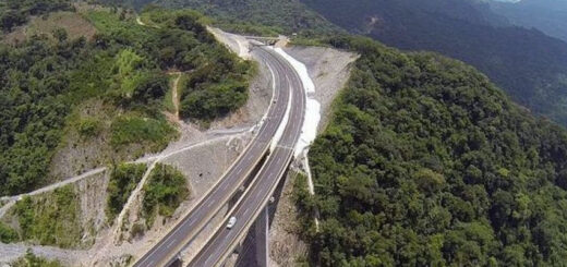
Tampico also has excellent railway facilities serving the port, which is well-developed with warehouses and equipment for loading oil tankers. Major roads connect to the Pan-American Highway.
Let us know if this article was useful for you