Puerto Escondido
Puerto Escondido, a coastal paradise on Mexico’s Pacific coast, is a gem in the state of Oaxaca. Renowned for its stunning beaches and vibrant local culture, Puerto Escondido offers a blend of relaxation and adventure.
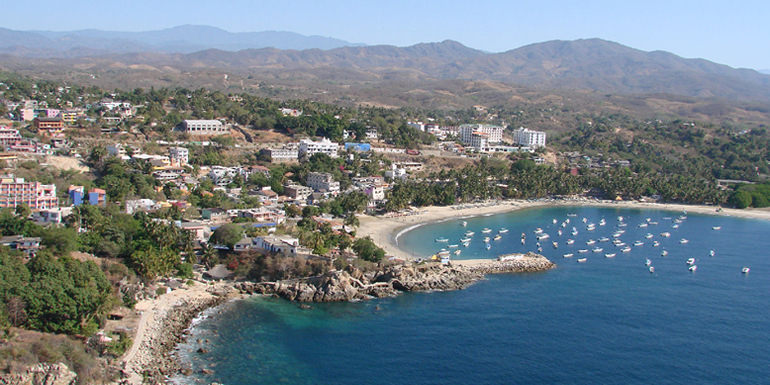
Puerto Escondido is located on the Oaxaca’s coast also known as the Emerald Coast. Its bay is adjoined by several rocky cliffs, which vary in height between 15 and 30 m. The town center is located on the north side of the bay.
Puerto Escondido is famous for its surf spots. The town charms visitors with its laid-back atmosphere, and diverse culinary scene, making it a must-visit destination for travelers seeking both excitement and tranquility.
Puerto Escondido is the oldest tourist attraction in the region and is the main center of tourist activity, both for nationals and foreigners. The large waves of Zicatela Beach put it into the top ten surfing destinations.
Puerto Escondido is mostly downscale and rustic, with many hotels and restaurants, but there are a few upscale hotels. The port continues to support commercial fishing activity, and it also attracts people for deep-sea fishing.
Geography and Environment
Nestled between the Sierra Madre del Sur mountains and the Pacific Ocean, Puerto Escondido boasts a unique geographic setting. The town is spread along a rugged coastline featuring sandy beaches, rocky cliffs, and lush vegetation.
The area is characterized by its natural beauty, including crystal-clear waters and vibrant marine life. The surrounding environment includes tropical dry forests and mangroves, contributing to the region’s rich biodiversity.
There are a variety of outdoor activities, from hiking and bird-watching to snorkeling and diving.
Climate and Weather
Puerto Escondido enjoys a tropical savanna climate, marked by a distinct dry season and a wet season. The dry season, from November to April, features warm temperatures averaging between 25°C and 30°C, with plenty of sunshine and minimal rainfall.
The wet season, from May to October, brings higher humidity and more frequent rain, often in short, intense bursts, with temperatures ranging from 26°C to 32°C. Despite the rain, the weather remains warm, making the area lush and green.
The best time to visit
The best time to visit Puerto Escondido is from November to April when the weather is ideal for beach activities, surfing, and exploring the town. This period offers sunny days, warm temperatures, and low humidity, perfect for outdoor adventures.
However, for avid surfers looking to catch the legendary waves of Zicatela Beach, the months of May to July are ideal, as the swells are at their peak, offering thrilling surfing conditions despite the occasional rain.
Origin of the name
The name “Puerto Escondido” translates to “Hidden Port” in English. Legend has it that the area was a favorite hideout for pirates, who used the secluded bays and coves to evade capture and stash their treasures.
The name “Puerto Escondido” is said to have originated from a story about a woman who escaped from pirate captivity and hid in the region, leading the locals to refer to the area as a hidden or concealed port.
The story states that a fierce pirate, Andrés Drake, brother of Sir Francis Drake, anchored his ship in the bay when the area was completely uninhabited, to rest for a few days unmolested by authorities.
Some weeks before, he and his crew kidnapped a young Mixtec woman from the village of Santa María Huatulco and took her prisoner. The woman jumped overboard to get to shore and hide in the jungle beyond the beach.
Since then, the pirates referred to the woman as “La Escondida” (the hidden one), and every time the ship returned to these waters, the captain ordered his crew to search the area around the bay, however, they never found her.
Hence, the area became known as the Bahía de la Escondida.
The Nahuatl word for this area was Zicatela, meaning “place of large thorns”.
History
The area around Puerto Escondido had been inhabited for centuries, but no towns of any size were established during the pre-Hispanic or colonial eras. The bay was known as Bahia de la Escondida (Bay of the Hidden Woman).
At the beginning of the 20th century, it was known as Punta Escondida (“Hidden Point”), then later, Puerto Escondido. At that time, it was just a small fishing village that intermittently was used to ship coffee.
Back then, Puerto Escondido suffered from a lack of potable water, although the Colotepec River ran nearby.
This caused people to settle in other places. Some did stay, including Nazario Castellanos and Escolástica Valencia, who were the night watchmen for the nearby coffee plantations and considered to be the town’s first residents.
There was no real town until the 1930s when Puerto Escondido’s activity as a port was more firmly established. The bay had been used as a port intermittently to ship coffee, but there was no permanent settlement due to the lack of potable water.
From the 1940s to the 1960s, a church was constructed and the first school was built. Wells were dug to alleviate the water supply problems, and generators were bought to supply electricity to the pumps and the few streetlights.
However, there were still problems getting needed outside supplies such as sugar. These commodities only arrived when a merchant ship entered the bay to sell its wares. Sometimes, this would not happen for months.
Residents got by with local products such as fish, poultry, iguanas, chicken, and turtle eggs. After the Sol de Vega road to the capital of Oaxaca was constructed, this problem was alleviated somewhat.
In the 1960s, was built the highway connecting Oaxacan coastal towns with Acapulco. Surfers and other tourists began to find the quiet beaches around Puerto Escondido and tourism began to flourish.
Its function as a port diminished as coffee began to be shipped by truck. Other infrastructure added included those to supply the area with potable water, a small airport where the Rinconada is now, mail service, and some government offices.
However, in the 1970s only about 400 people lived in Puerto Escondido. With time, Puerto Escondido’s importance as a tourist attraction increased, with hotels and resorts being constructed.
For many years, restaurants were almost exclusively in “palapas” (thatched roof shelters) with fishermen preparing their catches; however, these have mostly given way to modern tourist facilities.
Puerto Escondido is one of the most important tourist sites on the Oaxacan coast.
The community of Puerto Escondido is divided between two municipalities. The Zicatela Beach side belongs to the municipality of Santa María Colotepec and the western portion belongs to San Pedro Mixtepec.
On 30 July 2009, the state congress declared Puerto Escondido to be a city.
Beaches of Pueblo Escondido
The main attractions of Puerto Escondido are its beaches, which have become internationally known. The area also is attractive to scuba divers because of the variety of fish, large oysters, lobsters, and manta rays.
Although the Pacific Coast of Mexico generally runs north-south, this section of the coast in Oaxaca runs east-west, Playa Zicatela is on the eastern end.
Puerto Escondido became famous for surfing competitions held at Zicatela Beach every year in November. The competition brings competitors from various countries.
Nicknamed the “Mexican Pipeline” due to the similar power and shape of the Banzai Pipeline on the North Shore of Oahu, the wave that breaks on Zicatela Beach draws an international crowd of surfers, bodyboarders, and their entourages.
Mid to late summer is a low season for tourists, but a prime time for waves and international tournaments. Several international competitions such as the ESPN X Games, and the MexPipe Challenge have taken place.
This beach is separated from the other beaches by a rocky outcropping called “El Morro” (the nose).
The beach is 50 to 100 metres wide and four kilometres long with large waves that reach up to sixteen metres high. Lifeguards are stationed at this high-risk beach as well as on the other beaches.
About half of these are professional and the other half volunteers.
Zicatela is still a surfers’ beach, with the strong undertow making the area unsuitable for swimming. The Zicatela Beach tourist district caters to surfers, including specials on surfboard rentals.
The beach now has a promenade, landscaped with flowers and shrubs along the restaurants, many recently established.
West of Zicatela over the El Moro rocky outcrop is Playa Marinero, which is the best beach for swimming as the surf and undertow are much less. There is some surf, but gentle enough for beginning surfers and bodyboarding.
West from Playa Marinero is Playa Principal, or the main beach, fronting the town proper. This beach has boats and water taxis anchored close to shore. Here, fishermen arrive at dawn to sell their catch to local restaurants and families.
It is 500 m long with fine, gray sand and low to moderate surf. This is the primary place to hire boats that take tourists to otherwise inaccessible beaches, to see porpoises and marine turtles, or for deep-sea fishing.
This beach is also popular with Mexican families to picnic on and play soccer.
West of the Playa Principal is the lighthouse with a stone walkway, Andador Escénico, below it. From the end of the walkway, and a bit farther west, are the twin beaches of Puerto Angelito and Manzanillo, between which is a small rock outcropping.
These are on a sheltered cove, making it safe for swimming, with Manzanillo having slightly more surf. Angelito Beach has small, family-owned restaurants located in palapas (open-air thatched structures).
These beaches have water that varies in color from emerald green to turquoise blue. Puerto Angelito tends to be crowded and frequented by busloads of visitors. Playa Manzanillo is quieter as there is no road access.
West from these beaches is Playa Carrizalillo which has white sand and cobalt blue water edged in light green. This 300-metre-wide (980 ft) beach is on a small bay.
There are no vehicular roads to this beach, and the footpath descends a steep slope on a recently installed rock stairway. It takes about fifteen minutes to walk here from the town. A water taxi ride from Playa Principal is another option for accessing Carrizalillo.
Waves are normally gentle, except for a zone that opens directly onto the ocean where waves are big enough for surfing. The difficult access means that the beach is not as crowded with walking vendors as Puerto Angelito Beach.
There are few restaurants and the area is generally cleaner. On the east and west sides of the bay are rocky outcroppings that serve as habitat for a wide variety of fish and coral, making it popular for snorkeling.
Near Carrizalillo is the Rinconada, a former landing strip that is now lined with restaurants, salons, and shops. It also contains a lending library run by a local charity run by expatriates.
The westernmost beach is Playa Bacocho with upscale beach clubs. It has fine, soft sand, palm trees, warm, blue-green water, and moderate surf although the far west part of the beach can have a strong undertow. It faces southwest, offering good sunset views.
West of Bacocho are still undeveloped beaches.
One day trip from Puerto Escondido
Laguna de Manialtepec
About 10 km from Puerto Escondido is the Laguna de Manialtepec.
There is a small village on the way called Bajos de Chila and a small archeological zone of the Chatino culture. This site has a Sun Stone which represents the solar deity and a statue of a high-ranking priest.
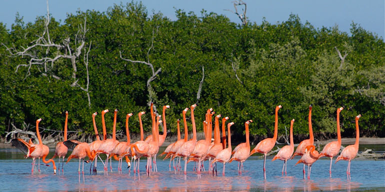
The lagoon is full of mangroves and many birds such as pelicans, seagulls, ibis, storks, cranes, jacanas, buzzards, kingfishers, swans, and other species. Other wildlife here includes raccoons, weasels, deer, wild boar, foxes, and crocodiles.
In the middle of the Laguna de Manialtepec there is an island named Gallo (“Rooster”), on which, according to legend, a rooster can be heard singing every year on December 24.
How to get there?
Puerto Escondido International Airport has flights to the cities of Oaxaca, Monterrey, and Mexico City.
Commercial busses from the city of Oaxaca take about seven hours.
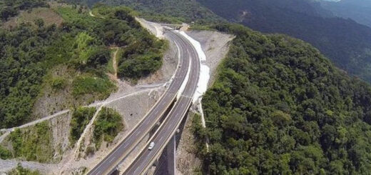
The new 3-lane superhighway from Oaxaca is coming to Ventanillas, Oaxaca, about 13 km east of Puerto Escondido, where it meets the old coastal Highway 200. This will cut the travel time from Oaxaca by more than half.
Fiestas de Noviembre
The Fiestas de Noviembre (Festivals of November) are held during the month into the beginning of December. Events are scheduled in the San Pedro Mixtepec and Santa María Colotepec jurisdictions and there is little coordination between the events.
This usually means a large number of events, more than a few concurrent and competing for attendees. Zicatela events are often staged on Playa Zicatela while the uptown events are often on Playa Principal or the municipal plaza west and above the main beach.
Some of the major events include a motocross event, a sailfishing competition, a festival of coastal dance, and a surfing tournament.
Let us know if this article was useful for you